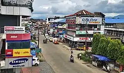
Vadakkencherry, Palakkad
Vadakkencherry | |
|---|---|
Town | |
 Vadakkencherry Town | |
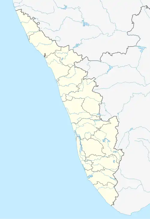 Vadakkencherry Location in Kerala  Vadakkencherry Location in India | |
| Coordinates: 10°35′25.9″N 76°29′00.2″E / 10.590528°N 76.483389°E | |
| Country | |
| State | Kerala |
| District | Palakkad |
| Government | |
| • Type | Panchayati raj (India) |
| • Body | Vadakkencherry Grama Panchayath |
| Area | |
• Total | 37.88 km2 (14.63 sq mi) |
| Population (2011)[1] | |
• Total | 35,969 |
| • Density | 950/km2 (2,500/sq mi) |
| Languages | |
| • Official | Malayalam, English |
| Time zone | UTC+5:30 (IST) |
| PIN | 678683 |
| Telephone code | 91 4922 |
| Vehicle registration | KL-9, KL-49 |
| Nearest city | Thrissur (33 km (21 mi) away) Palakkad (34 km (21 mi) away) |
| Parliament constituency | Alathur |
| State Legislative Assembly constituency | Tarur |
Vadakkencherry (IPA: [ʋɐɖɐkːɐɲdʒeːɾi]) is a town and gram panchayat[2] in the Palakkad district, state of Kerala, India.[3] It is located about 35 km from Palakkad along National Highway 544. Vadakkencherry-Mannuthy section of NH-544 is the first six lane National Highway in the state.
Etymology
The compound of vaṭakkan "northen" and cēri "slum".
Education
- College of Applied Science, Vadakkencherry
- St. Mary’s Polytechnic College, Vadakkenchery[4]
- Cherupushpam GHSS Vadakkencherry[5]
- Government Community College, Vadakkenchery[6]
- The Shobha Academy[7]
- Motherteresa School Vadakkencherry
- St Francis School, Elavampadam, Vadakkencherry
Transportation
Vadakkencherry has good connectivity across all major cities. It is located along National Highway 544. Public transportation is mainly through private and KSRTC bus services. A KSRTC operating centre is being operated from Vadakkencherry.[8] There is also a private bus stand usually called as Indira Priyadarshini Bus Stand to operate private bus service.[9] Nearest major railway stations are Palakkad Junction railway station and Thrissur railway station. Nearest airport is Cochin International Airport.
References
- ^ "പാലക്കാട് ജില്ലയിലെ ഗ്രാമ പഞ്ചായത്തുകളുടെ അടിസ്ഥാന വിവരങ്ങൾ".
- ^ "VADAKKANCHERI-VILLAGE PANCHAYAT". Panchayat Portals. Retrieved 17 October 2018.
- ^ "Pin Code: VADAKKANCHERRY MBR, PALAKKAD, KERALA, India, Pincode.net.in". pincode.net.in. Retrieved 26 August 2022.
- ^ "ST.MARY'S INSTITUTE OF TECHNOLOGY & SCIENCE". www.stmaryspolytechnic.in. Retrieved 27 August 2022.
- ^ "About Us". Cherupushpam GHSS Vadakkencherry. 8 February 2020. Retrieved 27 August 2022.
- ^ "Government Community College, Vadakkanchery". www.facebook.com. Retrieved 27 August 2022.
- ^ Sanandakumar, S. "CSR project: Sobha Group's PNC Menon developing Kerala's Palakkad region & educating children". The Economic Times.
- ^ "KSRTC Depots". 14 March 2011. Archived from the original on 14 March 2011. Retrieved 8 September 2022.
- ^ basheer, Shafeeq (5 December 2020), English: Priyadarshini Bus stand, Vadakkencherry, retrieved 26 August 2022