Tvarožná Lhota
Tvarožná Lhota | |
|---|---|
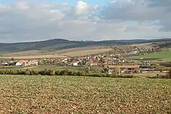 General view | |
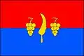 Flag 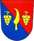 Coat of arms | |
 Tvarožná Lhota Location in the Czech Republic | |
| Coordinates: 48°52′38″N 17°21′34″E / 48.87722°N 17.35944°E | |
| Country | |
| Region | South Moravian |
| District | Hodonín |
| First mentioned | 1475 |
| Area | |
• Total | 17.46 km2 (6.74 sq mi) |
| Elevation | 207 m (679 ft) |
| Population (2025-01-01)[1] | |
• Total | 921 |
| • Density | 53/km2 (140/sq mi) |
| Time zone | UTC+1 (CET) |
| • Summer (DST) | UTC+2 (CEST) |
| Postal code | 696 62 |
| Website | www |
Tvarožná Lhota is a municipality and village in Hodonín District in the South Moravian Region of the Czech Republic. It has about 900 inhabitants.
Demographics
| Year | Pop. | ±% |
|---|---|---|
| 1869 | 863 | — |
| 1880 | 1,032 | +19.6% |
| 1890 | 993 | −3.8% |
| 1900 | 1,002 | +0.9% |
| 1910 | 939 | −6.3% |
| 1921 | 975 | +3.8% |
| 1930 | 1,011 | +3.7% |
| 1950 | 1,016 | +0.5% |
| 1961 | 1,054 | +3.7% |
| 1970 | 997 | −5.4% |
| 1980 | 936 | −6.1% |
| 1991 | 874 | −6.6% |
| 2001 | 851 | −2.6% |
| 2011 | 895 | +5.2% |
| 2021 | 881 | −1.6% |
| Source: Censuses[2][3] | ||
References
- ^ "Population of Municipalities – 1 January 2025". Czech Statistical Office. 2025-05-16.
- ^ "Historický lexikon obcí České republiky 1869–2011" (in Czech). Czech Statistical Office. 2015-12-21.
- ^ "Population Census 2021: Population by sex". Public Database. Czech Statistical Office. 2021-03-27.
External links
Wikimedia Commons has media related to Tvarožná Lhota.