Turck, Kansas
Turck, Kansas | |
|---|---|
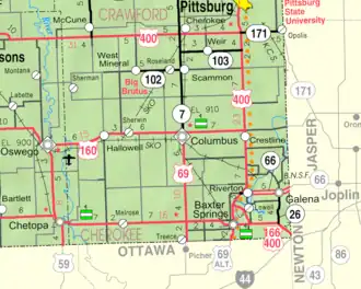 KDOT map of Cherokee County (legend) | |
 Turck  Turck | |
| Coordinates: 37°13′50″N 94°49′55″W / 37.23056°N 94.83194°W[1] | |
| Country | United States |
| State | Kansas |
| County | Cherokee |
| Elevation | 932 ft (284 m) |
| Time zone | UTC-6 (CST) |
| • Summer (DST) | UTC-5 (CDT) |
| Area code | 620 |
| FIPS code | 20-71650 |
| GNIS ID | 484451[1] |
Turck is an unincorporated community in Cherokee County, Kansas, United States.[1] Its elevation is 932 feet.[1]
History
Turck had a post office from 1889 until 1891.[2]
References
- ^ a b c d e U.S. Geological Survey Geographic Names Information System: Turck, Kansas
- ^ "Kansas Post Offices, 1828-1961, page 2". Kansas Historical Society. Retrieved June 6, 2014.
Further reading
External links
Municipalities and communities of Cherokee County, Kansas, United States | ||
|---|---|---|
| Cities | 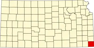 | |
| CDPs | ||
| Unincorporated communities | ||
| Ghost towns | ||
| Townships | ||
| Footnotes | ‡This community also has portions in an adjacent county or counties. | |