Talbot, Indiana
Talbot, Indiana | |
|---|---|
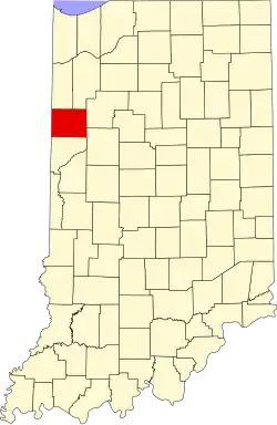 Benton County's location in Indiana | |
 Talbot Talbot's location in Benton County | |
| Coordinates: 40°30′19″N 87°27′15″W / 40.50528°N 87.45417°W | |
| Country | |
| State | |
| County | Benton |
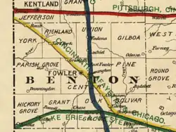
| Township | Hickory Grove |
| Platted | February 18, 1873 |
| Founded by | Ezekiel and Marietta Talbot |
| Elevation | 234 m (768 ft) |
| Time zone | UTC-5 (CST) |
| • Summer (DST) | UTC-4 (CDT) |
| ZIP code | 47944 |
| Area code | 765 |
| FIPS code | 18-74834[2] |
| GNIS feature ID | 444550 |
Talbot is an unincorporated community in Hickory Grove Township, Benton County, in the U.S. state of Indiana.[3] It is part of the Lafayette, Indiana Metropolitan Statistical Area.
History
The town of Talbot was laid out by Ezekiel M. Talbot[4] (chief engineer of the LM&B Railroad) and his wife Marietta on February 18, 1873, the plat consisting of 71 lots. The couple would also lay out the nearby town of Ambia two years later.[5] In the 1920s, Talbot had a population of about 200, plus a Methodist church, grain elevator, grade school and eight to ten businesses.[6]
A post office was established at Talbot in 1873, and remained in operation until it was discontinued in 1995.[7]
Geography
Talbot is located at 40°30′19″N 87°27′15″W / 40.50528°N 87.45417°W in Hickory Grove Township and is surrounded by open, fertile farmland. The Kankakee, Beaverville and Southern Railroad passes through the town, and intersects the short Bee Line Railroad a mile to the west at a point known as Handy.
References
- ^ "US Board on Geographic Names". United States Geological Survey. October 25, 2007. Retrieved January 31, 2008.
- ^ "U.S. Census website". United States Census Bureau. Retrieved January 31, 2008.
- ^ "Talbot, Indiana". Geographic Names Information System. United States Geological Survey. Retrieved February 29, 2020.
- ^ Baker, Ronald L. (October 1995). From Needmore to Prosperity: Hoosier Place Names in Folklore and History. Indiana University Press. p. 319. ISBN 978-0-253-32866-3.
...was laid out on February 18, 1873, by Ezekiel M. Talbot and named for him.
- ^ Mossman, Ed (1883). "History of Benton County: Past Events -- Present Condition". Counties of Warren, Benton, Jasper and Newton, Indiana: Historical and Biographical. Chicago: F. A. Battey & Co.
- ^ Birch, Jesse Setlington (1942) [1928]. "Unincorporated community s of the County". History of Benton County and Historic Oxford. Oxford, Indiana: Craw & Craw. p. 206.
- ^ "Benton County". Jim Forte Postal History. Retrieved February 29, 2020.
Municipalities and communities of Benton County, Indiana, United States | ||
|---|---|---|
| Towns | | |
| Townships | ||
| CDPs | ||
| Other communities |
| |
| Ghost towns | ||
| Footnotes | ‡This populated place also has portions in an adjacent county or counties | |