Suratá
Suratá | |
|---|---|
Municipality and town | |
 | |
.svg.png) Flag | |
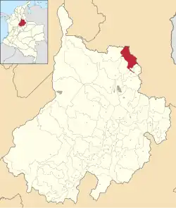 Location of the municipality and town of Suratá in the Santander Department of Colombia | |
| Coordinates: 7°22′N 72°59′W / 7.367°N 72.983°W | |
| Country | |
| Department | Santander Department |
| Time zone | UTC-5 (Colombia Standard Time) |
Suratá is a town and municipality in the Santander Department in northeastern Colombia.
Climate
| Climate data for Suratá (Vivero Surata), elevation 1,725 m (5,659 ft), (1981–2010) | |||||||||||||
|---|---|---|---|---|---|---|---|---|---|---|---|---|---|
| Month | Jan | Feb | Mar | Apr | May | Jun | Jul | Aug | Sep | Oct | Nov | Dec | Year |
| Mean daily maximum °C (°F) | 22.7 (72.9) |
23.1 (73.6) |
23.2 (73.8) |
22.8 (73.0) |
22.6 (72.7) |
22.8 (73.0) |
22.9 (73.2) |
23.0 (73.4) |
22.4 (72.3) |
21.9 (71.4) |
21.9 (71.4) |
22.2 (72.0) |
22.6 (72.7) |
| Daily mean °C (°F) | 17.5 (63.5) |
18.0 (64.4) |
18.0 (64.4) |
17.8 (64.0) |
17.9 (64.2) |
18.0 (64.4) |
17.8 (64.0) |
17.8 (64.0) |
17.4 (63.3) |
17.2 (63.0) |
17.3 (63.1) |
17.4 (63.3) |
17.7 (63.9) |
| Mean daily minimum °C (°F) | 12.4 (54.3) |
13.0 (55.4) |
13.3 (55.9) |
13.6 (56.5) |
13.9 (57.0) |
13.8 (56.8) |
13.3 (55.9) |
13.5 (56.3) |
13.3 (55.9) |
13.2 (55.8) |
13.0 (55.4) |
12.7 (54.9) |
13.2 (55.8) |
| Average precipitation mm (inches) | 18.1 (0.71) |
31.0 (1.22) |
58.9 (2.32) |
143.4 (5.65) |
157.4 (6.20) |
72.8 (2.87) |
52.0 (2.05) |
89.2 (3.51) |
147.2 (5.80) |
200.8 (7.91) |
110.7 (4.36) |
36.3 (1.43) |
1,117.8 (44.01) |
| Average precipitation days | 5 | 7 | 10 | 16 | 17 | 12 | 13 | 16 | 20 | 20 | 15 | 8 | 159 |
| Average relative humidity (%) | 81 | 80 | 82 | 86 | 87 | 85 | 83 | 84 | 85 | 88 | 88 | 84 | 85 |
| Mean monthly sunshine hours | 210.8 | 177.8 | 170.5 | 132.0 | 133.3 | 144.0 | 167.4 | 155.0 | 132.0 | 124.0 | 141.0 | 182.9 | 1,870.7 |
| Mean daily sunshine hours | 6.8 | 6.3 | 5.5 | 4.4 | 4.3 | 4.8 | 5.4 | 5.0 | 4.4 | 4.0 | 4.7 | 5.9 | 5.1 |
| Source: Instituto de Hidrologia Meteorologia y Estudios Ambientales[1] | |||||||||||||
| Climate data for Suratá (Cachiri), elevation 1,850 m (6,070 ft), (1981–2010) | |||||||||||||
|---|---|---|---|---|---|---|---|---|---|---|---|---|---|
| Month | Jan | Feb | Mar | Apr | May | Jun | Jul | Aug | Sep | Oct | Nov | Dec | Year |
| Mean daily maximum °C (°F) | 24.7 (76.5) |
25.3 (77.5) |
25.0 (77.0) |
24.3 (75.7) |
23.7 (74.7) |
23.6 (74.5) |
24.1 (75.4) |
24.2 (75.6) |
24.3 (75.7) |
23.7 (74.7) |
23.4 (74.1) |
23.7 (74.7) |
24.2 (75.6) |
| Daily mean °C (°F) | 18.6 (65.5) |
18.7 (65.7) |
18.7 (65.7) |
18.5 (65.3) |
18.5 (65.3) |
18.5 (65.3) |
18.6 (65.5) |
18.7 (65.7) |
18.5 (65.3) |
18.2 (64.8) |
18.3 (64.9) |
18.4 (65.1) |
18.5 (65.3) |
| Mean daily minimum °C (°F) | 13.1 (55.6) |
13.3 (55.9) |
13.8 (56.8) |
14.3 (57.7) |
14.6 (58.3) |
14.4 (57.9) |
14.1 (57.4) |
14.2 (57.6) |
14.1 (57.4) |
14.1 (57.4) |
14.1 (57.4) |
13.5 (56.3) |
14.0 (57.2) |
| Average precipitation mm (inches) | 30.4 (1.20) |
45.4 (1.79) |
80.9 (3.19) |
150.3 (5.92) |
145.7 (5.74) |
66.8 (2.63) |
39.2 (1.54) |
72.7 (2.86) |
126.4 (4.98) |
180.4 (7.10) |
135.1 (5.32) |
49.2 (1.94) |
1,122.7 (44.20) |
| Average precipitation days | 6 | 8 | 11 | 17 | 17 | 12 | 10 | 14 | 18 | 20 | 15 | 8 | 155 |
| Average relative humidity (%) | 81 | 81 | 81 | 84 | 84 | 84 | 83 | 82 | 83 | 85 | 85 | 83 | 83 |
| Mean monthly sunshine hours | 207.7 | 175.0 | 164.3 | 129.0 | 124.0 | 129.0 | 158.1 | 155.0 | 138.0 | 130.2 | 150.0 | 179.8 | 1,840.1 |
| Mean daily sunshine hours | 6.7 | 6.2 | 5.3 | 4.3 | 4.0 | 4.3 | 5.1 | 5.0 | 4.6 | 4.2 | 5.0 | 5.8 | 5.0 |
| Source: Instituto de Hidrologia Meteorologia y Estudios Ambientales[1] | |||||||||||||
References
- ^ a b "Promedios Climatológicos 1981–2010" (in Spanish). Instituto de Hidrologia Meteorologia y Estudios Ambientales. Archived from the original on 15 August 2016. Retrieved 17 June 2024.