Strachotice
Strachotice | |
|---|---|
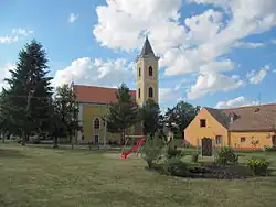 Church of Saint George | |
 Coat of arms | |
 Strachotice Location in the Czech Republic | |
| Coordinates: 48°47′46″N 16°10′20″E / 48.79611°N 16.17222°E | |
| Country | |
| Region | South Moravian |
| District | Znojmo |
| First mentioned | 1190 |
| Area | |
• Total | 20.48 km2 (7.91 sq mi) |
| Elevation | 197 m (646 ft) |
| Population (2025-01-01)[1] | |
• Total | 1,032 |
| • Density | 50/km2 (130/sq mi) |
| Time zone | UTC+1 (CET) |
| • Summer (DST) | UTC+2 (CEST) |
| Postal code | 671 29 |
| Website | www |
Strachotice is a municipality and village in Znojmo District in the South Moravian Region of the Czech Republic. It has about 1,000 inhabitants.
Strachotice lies approximately 12 kilometres (7 mi) south-east of Znojmo, 55 km (34 mi) south-west of Brno, and 192 km (119 mi) south-east of Prague.
Administrative division
Strachotice consists of two municipal parts (in brackets population according to the 2021 census):[2]
- Strachotice (443)
- Micmanice (561)
Demographics
| Year | Pop. | ±% |
|---|---|---|
| 1869 | 1,801 | — |
| 1880 | 1,991 | +10.5% |
| 1890 | 2,028 | +1.9% |
| 1900 | 2,030 | +0.1% |
| 1910 | 2,061 | +1.5% |
| 1921 | 2,061 | +0.0% |
| 1930 | 2,120 | +2.9% |
| 1950 | 1,161 | −45.2% |
| 1961 | 1,076 | −7.3% |
| 1970 | 935 | −13.1% |
| 1980 | 924 | −1.2% |
| 1991 | 943 | +2.1% |
| 2001 | 957 | +1.5% |
| 2011 | 1,001 | +4.6% |
| 2021 | 1,004 | +0.3% |
| Source: Censuses[3][4] | ||
References
- ^ "Population of Municipalities – 1 January 2025". Czech Statistical Office. 2025-05-16.
- ^ "Public Census 2021 – basic data". Public Database (in Czech). Czech Statistical Office. 2022.
- ^ "Historický lexikon obcí České republiky 1869–2011" (in Czech). Czech Statistical Office. 2015-12-21.
- ^ "Population Census 2021: Population by sex". Public Database. Czech Statistical Office. 2021-03-27.
External links
Wikimedia Commons has media related to Strachotice.