Square Peak
| Square Peak | |
|---|---|
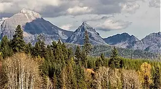 Square Peak (centered) and Rainbow Peak (left) seen from the west at Big Prairie | |
| Highest point | |
| Elevation | 8,781 ft (2,676 m)[1] |
| Prominence | 1,017 ft (310 m)[1] |
| Coordinates | 48°52′00″N 114°06′16″W / 48.86667°N 114.10444°W[2] |
| Geography | |
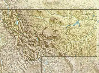 Square Peak Location in Montana  Square Peak Location in the United States | |
| Location | Flathead County, Montana, U.S. |
| Parent range | Livingston Range |
| Topo map(s) | USGS Vulture Peak, MT |
Square Peak (8,781 feet (2,676 m)) is located in the Livingston Range, Glacier National Park in the U.S. state of Montana.[3] Square Peak is .63 miles (1.01 km) SSW of Rainbow Peak.
See also
References
- ^ a b "Square Peak, Montana". Peakbagger.com. Retrieved January 16, 2019.
- ^ "Square Peak". Geographic Names Information System. United States Geological Survey, United States Department of the Interior. Retrieved January 16, 2019.
- ^ Vulture Peak, MT (Map). TopoQwest (United States Geological Survey Maps). Retrieved January 16, 2019.
.jpg)