Spreewaldheide
Spreewaldheide | |
|---|---|
Location of Spreewaldheide within Dahme-Spreewald district 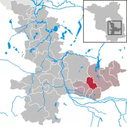 | |
 Spreewaldheide 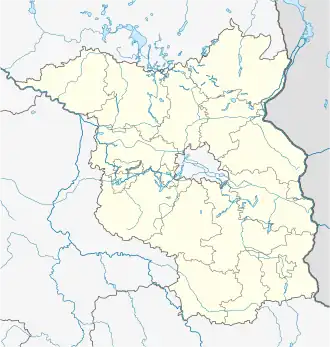 Spreewaldheide | |
| Coordinates: 51°57′10″N 14°08′15″E / 51.95278°N 14.13750°E | |
| Country | Germany |
| State | Brandenburg |
| District | Dahme-Spreewald |
| Municipal assoc. | Lieberose/Oberspreewald |
| Government | |
| • Mayor (2024–29) | Daniel Zimmer[1] (CDU) |
| Area | |
• Total | 35.99 km2 (13.90 sq mi) |
| Elevation | 54 m (177 ft) |
| Population (2023-12-31)[2] | |
• Total | 431 |
| • Density | 12/km2 (31/sq mi) |
| Time zone | UTC+01:00 (CET) |
| • Summer (DST) | UTC+02:00 (CEST) |
| Postal codes | 15913 |
| Dialling codes | 035475 |
| Vehicle registration | LDS |
Spreewaldheide (Lower Sorbian: Błośańska Góla) is a municipality in the district of Dahme-Spreewald in Brandenburg in Germany.
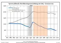
Demography
|
|
|
References
- ^ Landkreis Dahme-Spreewald Wahl der Bürgermeisterin / des Bürgermeisters. Retrieved 27 June 2024.
- ^ "Bevölkerungsstand im Land Brandenburg Dezember 2023] (Fortgeschriebene amtliche Einwohnerzahlen, basierend auf dem Zensus 2022)". Amt für Statistik Berlin-Brandenburglanguage=German.
- ^ Detailed data sources are to be found in the Wikimedia Commons.Population Projection Brandenburg at Wikimedia Commons