Sofia Region
Sofia Region | |
|---|---|
Region | |
 Sofia | |
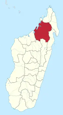 Location in Madagascar | |
| Country | |
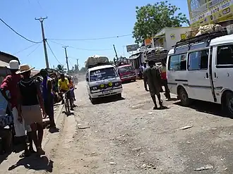
| Capital | Antsohihy |
| Government | |
| • Governor | René de Rolland Urbain Lylison |
| Area | |
• Total | 50,100 km2 (19,300 sq mi) |
| Population (2018)[2] | |
• Total | 1,500,227 |
| • Density | 30/km2 (78/sq mi) |
| Time zone | UTC3 (EAT) |
| HDI (2018) | 0.538[3] low · 6th of 22 |
Sofia is a region in northern Madagascar. It is named for the Sofia River. It is the second largest Malagasy region (behind Atsimo-Andrefana) with an area of 50,100 km² (19,300 sq mi), and had a population of 1,500,227 in 2018.[2] Antsohihy is the administrative capital.
Administrative divisions
Sofia Region is divided into seven districts, which are sub-divided into 108 communes.
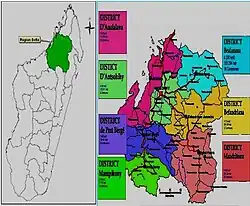
- Analalava District - 11 communes
- Antsohihy District - 12 communes
- Bealanana District - 13 communes
- Befandriana-Nord District - 12 communes
- Boriziny-Vaovao District - 15 communes
- Mampikony District - 6 communes
- Mandritsara District - 22 communes
Transport
Airports
- Analalava Airport
- Antsohihy Airport
- Bealanana Airport
- Befandriana-Avaratra Airport
- Mampikony Airport
- Mandritsara Airport
- Boriziny Vaovao Airport
Roads
Sofia is crossed by the National Road 4 (Antananarivo-Mahajanga), National Road 6 (Antsohihy-Diego Suarez), the National road 31 (Antsohihy to Mandritsara) and National road 32 (Antsohihy to Bealanana).
Protected Areas
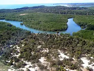
Sofia disposes of the highest concentration of mangroves in Madagascar with a total surface of 450 km2.[4]
- Bongolava forest corridor
- Marotandrano Reserve
- Bora Reserve
- Tampoketsa Analamaitso Reserve
- Radama Islands/Sahamalaza National Park
- Bemanevika New Protected Area
- Mahimborondro New Protected Area
- Part of Makira Natural Park
- Anjajavy Forest New Protected Area
External links
- (in French) Official Website
References
- ^ EDBM
- ^ a b "Troisieme Recensement General de la Population et de L'Habitation (RGPH-3) Resultats Provisoires" (PDF). Institut National de la Statistique Madagascar. Retrieved May 23, 2020.
- ^ "Sub-national HDI - Area Database - Global Data Lab". hdi.globaldatalab.org. Retrieved 2018-09-13.
- ^ L'Express/mg: Ananalava mangroves
Capital: Antsohihy | ||
| Analalava (11) (407) | 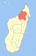 | |
| Antsohihy (12) (407) | ||
| Bealanana (13) (407) | ||
| Befandriana-Nord (12) (409) | ||
| Boriziny (15) (Port-Bergé) (419) |
| |
| Mampikony (6) (414) | ||
| Mandritsara (22) (415) | ||
7 districts; 91 communes | ||
14°52′47″S 47°59′15″E / 14.87961°S 47.987518°E