Skamokawa, Washington
Skamokawa, Washington | |
|---|---|
 | |
 Skamokawa | |
| Coordinates: 46°17′15″N 123°27′19″W / 46.28750°N 123.45528°W | |
| Country | United States |
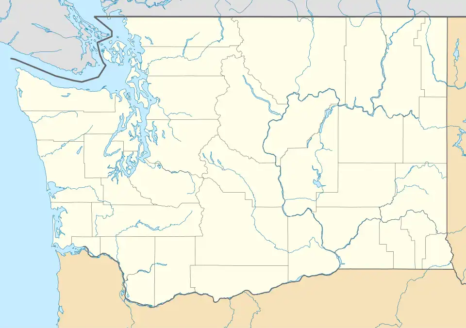
| State | Washington |
| Counties | Wahkiakum County |
| Elevation | 30 ft (9 m) |
| Population (2007) | |
• Total | 449 |
| Time zone | UTC-8 (PST) |
| • Summer (DST) | UTC-7 (PDT) |
| ZIP codes | 98647 |
| Area code | Area code 360 |
| GNIS feature ID | 1508379[1] |
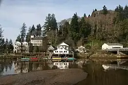
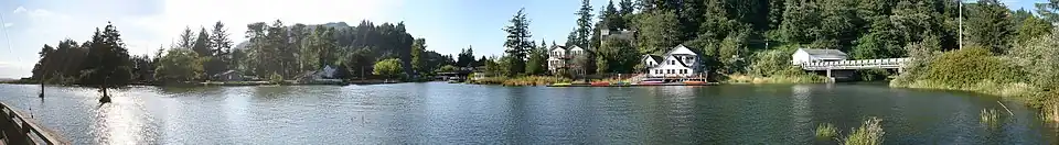
Skamokawa (/skʌˈmɑːkəˌweɪ/) is an unincorporated community in Wahkiakum County, Washington, United States. Skamokawa Valley, a census-designated place (CDP), lies directly to the north. Skamokawa is a Chinook term for smoke or fog on the water.[2]
Skamokawa rests on the banks of the Columbia River, and on WA 4. The region's first American trading post was established near Skamokawa in 1844.[3]
The town includes a post office, restaurant, and general store, along with a nearby historical museum and covered bridge. Originally focused on logging, is now a local center for kayaking and fishing.
Gallery
-
.jpg) Post Office
Post Office -
.jpg)
-
.jpg) General Store
General Store -
.jpeg) Donkey engine crew, c. 1918
Donkey engine crew, c. 1918 -
.jpeg) Felling men, c. 1918
Felling men, c. 1918 -
.jpeg) Rafting logs, c. 1918
Rafting logs, c. 1918
References
- ^ "US Board on Geographic Names". United States Geological Survey. October 25, 2007. Retrieved January 31, 2008.
- ^ Majors, Harry M. (1975). Exploring Washington. Van Winkle Publishing Co. p. 114. ISBN 978-0-918664-00-6.
- ^ Martin, Irene (1997). Beaches of Heaven: A History of Wahkiakum County. Washington State University Press. p. 3. ISBN 0-87422-156-0.
External links
Wikimedia Commons has media related to Skamokawa, Washington.
Municipalities and communities of Wahkiakum County, Washington, United States | ||
|---|---|---|
| Town | 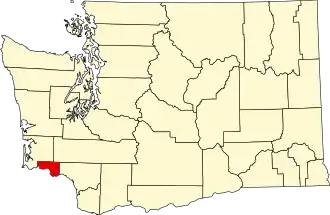 | |
| CDPs | ||
| Other communities | ||