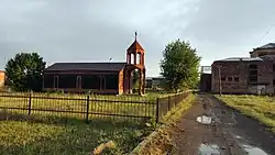
Shirakavan, Armenia
40°39′33″N 43°44′19″E / 40.65917°N 43.73861°E
Shirakavan
Շիրակավան | |
|---|---|
 | |
 Shirakavan 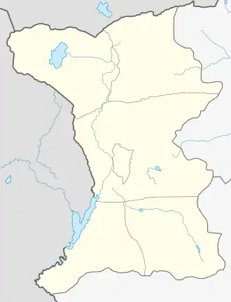 Shirakavan | |
| Coordinates: 40°39′33″N 43°44′19″E / 40.65917°N 43.73861°E | |
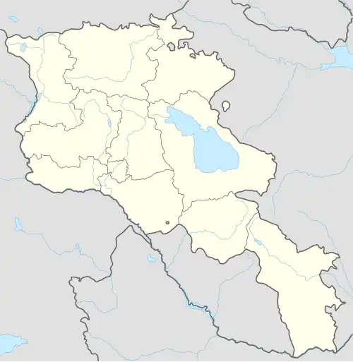
| Country | Armenia |
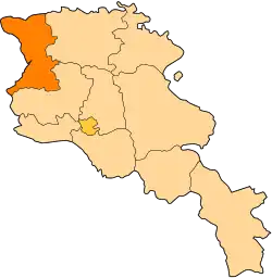
| Province | Shirak |
| Municipality | Ani |
| Established | 1976 |
| Government | |
| • Mayor | Marat Mkrtchyan |
| Area | |
• Total | 18.7 km2 (7.2 sq mi) |
| Elevation | 1,510 m (4,950 ft) |
| Population (2011) | |
• Total | 698[1] |
| Time zone | UTC+4 |
Shirakavan (Armenian: Շիրակավան) is a village in the Ani Municipality of the Shirak Province of Armenia, near the border of Turkey.
Demographics
The population of the village since 1831 is as follows:[2]
| Year | Pop. | ±% p.a. |
|---|---|---|
| 1831 | 403 | — |
| 1897 | 903 | +1.23% |
| 1926 | 685 | −0.95% |
| 1939 | 786 | +1.06% |
| 1959 | 454 | −2.71% |
| 1970 | 426 | −0.58% |
| 1979 | 432 | +0.16% |
| 1989 | 933 | +8.00% |
| 2001 | 743 | −1.88% |
| 2011 | 698 | −0.62% |
| Source: [2] | ||
References
- ^ "Shirak (Armenia): Towns and Villages in Municipalities". www.citypopulation.de. Retrieved 2025-07-17.
- ^ a b Հայաստանի Հանրապետության բնակավայրերի բառարան [Republic of Armenia settlements dictionary] (PDF) (in Armenian). Yerevan: Cadastre Committee of the Republic of Armenia. 2008. Archived from the original (PDF) on 11 March 2018.