Sentinel, Arizona
Sentinel, Arizona | |
|---|---|
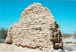 Ruins of the 1895 Sentinel Train Depot | |
 Sentinel Location within the state of Arizona  Sentinel Sentinel (the United States) | |
| Coordinates: 32°51′29″N 113°12′38″W / 32.85806°N 113.21056°W | |
| Country | United States |
| State | Arizona |
| County | Maricopa |
| Elevation | 692 ft (211 m) |
| Time zone | UTC-7 (Mountain (MST)) |
| • Summer (DST) | UTC-7 (MST) |
| Area code | 928 |
| FIPS code | 04-65630 |
| GNIS feature ID | 11083 |
Sentinel is an unincorporated community in Maricopa County, Arizona, United States.[2] It has an estimated elevation of 692 feet (211 m) above sea level.[1]
The train station served the US Army training camps: Camp Horn and Camp Hyder during World War II.[3]
Sentinel ruins
Some of the late 19th Century ruins in Sentinel.
Ruins in Sentinel, Arizona
-
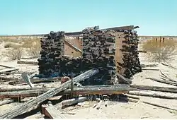 1890 Ranch house.
 -
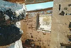 Inside the Ranch house.
 -
 Basement of the Ranch house
 -
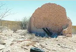 Ruins of the 1895 Sentinel Train Depot
See also
References
External links
![]() Media related to Sentinel, Arizona at Wikimedia Commons
Media related to Sentinel, Arizona at Wikimedia Commons
Municipalities and communities of Maricopa County, Arizona, United States | ||
|---|---|---|
| Cities |  | |
| Towns | ||
| CDPs | ||
| Populated places |
| |
| Indian reservations | ||
| Ghost towns/ former populated places | ||
| Footnotes | ‡This populated place also has portions in an adjacent county or counties | |