Scrignac
Scrignac
Skrigneg | |
|---|---|
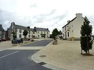 The main square in Scrignac, in 2010 | |
Location of Scrignac | |
 Scrignac  Scrignac | |
| Coordinates: 48°26′01″N 3°40′34″W / 48.4336°N 3.6761°W | |
| Country | France |
| Region | Brittany |
| Department | Finistère |
| Arrondissement | Châteaulin |
| Canton | Carhaix-Plouguer |
| Intercommunality | Monts d'Arrée |
| Government | |
| • Mayor (2020–2026) | Georges Morvan[1] |
Area 1 | 70.94 km2 (27.39 sq mi) |
| Population (2022)[2] | 781 |
| • Density | 11/km2 (29/sq mi) |
| Time zone | UTC+01:00 (CET) |
| • Summer (DST) | UTC+02:00 (CEST) |
| INSEE/Postal code | 29275 /29640 |
| Elevation | 86–281 m (282–922 ft) |
| 1 French Land Register data, which excludes lakes, ponds, glaciers > 1 km2 (0.386 sq mi or 247 acres) and river estuaries. | |
Scrignac (French pronunciation: [skʁiɲak]; Breton: Skrigneg) is a commune in the Finistère department of Brittany in north-western France.
Population
Inhabitants of Scrignac are called in French Scrignaciens.
.jpg)
|
| ||||||||||||||||||||||||||||||||||||||||||||||||||||||||||||||||||||||||||||||||||||||||||||||||||||||||||||||||||
| Source: EHESS[3] and INSEE (1968-2017)[4] | |||||||||||||||||||||||||||||||||||||||||||||||||||||||||||||||||||||||||||||||||||||||||||||||||||||||||||||||||||
See also
References
- ^ "Répertoire national des élus: les maires". data.gouv.fr, Plateforme ouverte des données publiques françaises (in French). 2 December 2020.
- ^ "Populations de référence 2022" (in French). The National Institute of Statistics and Economic Studies. 19 December 2024.
- ^ Des villages de Cassini aux communes d'aujourd'hui: Commune data sheet Scrignac, EHESS (in French).
- ^ Population en historique depuis 1968, INSEE
External links
Wikimedia Commons has media related to Scrignac.
- Base Mérimée: Search for heritage in the commune, Ministère français de la Culture. (in French)
- Mayors of Finistère Association (in French)