Sankt Martin an der Raab
Sankt Martin an der Raab | |
|---|---|
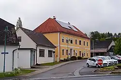 Main square and town hall | |
 Coat of arms | |
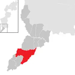 Location within Jennersdorf district | |
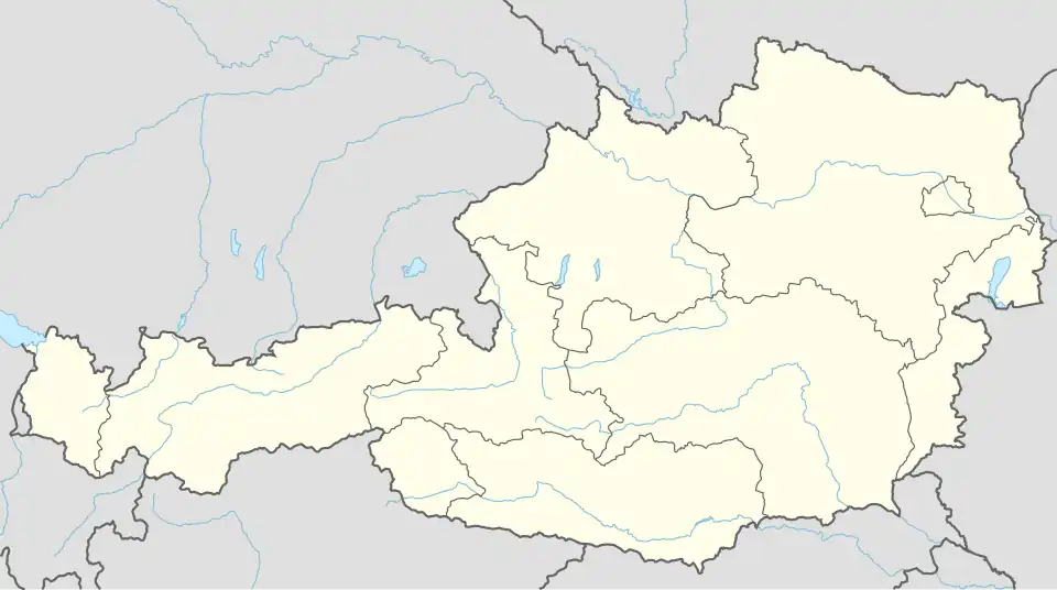 Sankt Martin an der Raab Location within Austria | |
| Coordinates: 46°55′N 16°8′E / 46.917°N 16.133°E | |
| Country | Austria |
| State | Burgenland |
| District | Jennersdorf |
| Government | |
| • Mayor | Franz Josef Kern (SPÖ) |
| Area | |
• Total | 43.01 km2 (16.61 sq mi) |
| Elevation | 250 m (820 ft) |
| Population (2018-01-01)[2] | |
• Total | 1,959 |
| • Density | 46/km2 (120/sq mi) |
| Time zone | UTC+1 (CET) |
| • Summer (DST) | UTC+2 (CEST) |
| Postal code | 8383 |
| Website | https://st-martin-raab.at/ |
Sankt Martin an der Raab (Hungarian: Rábaszentmárton, Rába-Szentmárton, Slovene: Sveti Martin pri Rabi) is a town in the district of Jennersdorf in the Austrian state of Burgenland.
Geography
Cadastral communities are Doiber, Gritsch, Neumarkt an der Raab, Oberdrosen, Sankt Martin an der Raab and Welten.[3]
Population
| Year | Pop. | ±% |
|---|---|---|
| 1869 | 3,518 | — |
| 1880 | 3,506 | −0.3% |
| 1890 | 3,605 | +2.8% |
| 1900 | 3,590 | −0.4% |
| 1910 | 3,533 | −1.6% |
| 1923 | 3,295 | −6.7% |
| 1934 | 3,172 | −3.7% |
| 1939 | 2,990 | −5.7% |
| 1951 | 2,725 | −8.9% |
| 1961 | 2,458 | −9.8% |
| 1971 | 2,595 | +5.6% |
| 1981 | 2,428 | −6.4% |
| 1991 | 2,189 | −9.8% |
| 2001 | 2,095 | −4.3% |
| 2011 | 2,053 | −2.0% |
References
- ^ "Dauersiedlungsraum der Gemeinden Politischen Bezirke und Bundesländer - Gebietsstand 1.1.2018". Statistics Austria. Retrieved 10 March 2019.
- ^ "Einwohnerzahl 1.1.2018 nach Gemeinden mit Status, Gebietsstand 1.1.2018". Statistics Austria. Retrieved 9 March 2019.
- ^ Katastralgemeindenverzeichnis, www.bev.gv.at