Sainte-Barbe, Quebec
Sainte-Barbe | |
|---|---|
 | |
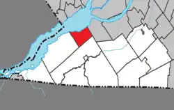 Location within Le Haut-Saint-Laurent RCM | |
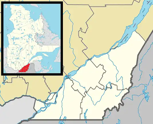 Sainte-Barbe Location in southern Quebec | |
| Coordinates: 45°10′N 74°12′W / 45.167°N 74.200°W[1] | |
| Country | Canada |
| Province | Quebec |
| Region | Montérégie |
| RCM | Le Haut-Saint-Laurent |
| Constituted | June 12, 1882 |
| Government | |
| • Mayor | Louise Lebrun |
| • Federal riding | Beauharnois—Salaberry |
| • Prov. riding | Huntingdon |
| Area | |
• Total | 67.50 km2 (26.06 sq mi) |
| • Land | 40.14 km2 (15.50 sq mi) |
| Population (2021)[4] | |
• Total | 1,609 |
| • Density | 40.1/km2 (104/sq mi) |
| • Pop 2016-2021 | |
| • Dwellings | 895 |
| Time zone | UTC−5 (EST) |
| • Summer (DST) | UTC−4 (EDT) |
| Postal code(s) | |
| Area codes | 450 and 579 |
| Highways | |
| Website | www |
Sainte-Barbe (French pronunciation: [sɛ̃t baʁb] ⓘ) is a municipality of Quebec, located within Le Haut-Saint-Laurent Regional County Municipality in the Montérégie administrative region. The population as of the Canada 2021 Census was 1,609.
History
Sainte-Barbe was created on January 1, 1883, by splitting away from Saint-Anicet. The name honors Saint Barbara and pays homage to Marie-Barbe de Boullongne (1618-1685), wife of Louis d'Ailleboust de Coulonge, governor of New France. On April 4, 2009, Sainte-Barbe changed its status from parish municipality to municipality.
Geography
Communities
The following locations reside within the municipality's boundaries:[1]
- Pointe-Biron (45°10′33″N 74°14′43″W / 45.17583°N 74.24528°W) – a residential area on the south shore of the Saint Lawrence River along Route 132.
- Pointe-Lalonde (45°10′33″N 74°13′57″W / 45.17583°N 74.23250°W) – a residential area on the south shore of the Saint Lawrence River along Route 132.
Lakes & Rivers
The following waterways pass through or are situated within the municipality's boundaries:[1]
- Saint Lawrence River – situated at municipality's northern boundary.
Demographics
Population
| 2021 | 2016 | 2011 | |
|---|---|---|---|
| Population | 1,609 (+21.5% from 2016) | 1,324 (-5.6% from 2011) | 1,403 (-3.4% from 2006) |
| Land area | 40.14 km2 (15.50 sq mi) | 40.16 km2 (15.51 sq mi) | 40.24 km2 (15.54 sq mi) |
| Population density | 40.1/km2 (104/sq mi) | 33.0/km2 (85/sq mi) | 34.9/km2 (90/sq mi) |
| Median age | 51.2 (M: 50.4, F: 52.4) | 51.5 (M: 51.6, F: 51.3) | 47.1 (M: 47.3, F: 46.8) |
| Private dwellings | 895 (total) | 787 (total) | 790 (total) |
| Median household income | $78,500 | $65,792 | $48,371 |
| Year | Pop. | ±% |
|---|---|---|
| 1991 | 1,307 | — |
| 1996 | 1,277 | −2.3% |
| 2001 | 1,338 | +4.8% |
| 2006 | 1,453 | +8.6% |
| 2011 | 1,403 | −3.4% |
| 2016 | 1,324 | −5.6% |
| 2021 | 1,609 | +21.5% |
Language
| Canada Census Mother Tongue - Sainte-Barbe, Quebec[8] | ||||||||||||||||||
|---|---|---|---|---|---|---|---|---|---|---|---|---|---|---|---|---|---|---|
| Census | Total | French
|
English
|
French & English
|
Other
| |||||||||||||
| Year | Responses | Count | Trend | Pop % | Count | Trend | Pop % | Count | Trend | Pop % | Count | Trend | Pop % | |||||
2021
|
1,610
|
1,485 | 92.2% | 85 | 5.3% | 20 | 1.2% | 15 | 0.9% | |||||||||
2016
|
1,325
|
1,245 | 94.0% | 65 | 4.9% | 10 | 0.8% | 10 | 0.8% | |||||||||
2011
|
1,395
|
1,325 | 95.0% | 60 | 4.3% | 5 | 0.4% | 5 | 0.4% | |||||||||
2006
|
1,445
|
1,335 | 92.4% | 95 | 6.6% | 0 | 0.0% | 15 | 1.0% | |||||||||
2001
|
1,325
|
1,225 | 92.5% | 65 | 4.9% | 20 | 42.9% | 15 | 50.0% | |||||||||
1996
|
1,275
|
1,210 | n/a | 98.8% | 30 | n/a | 0.7% | 35 | n/a | 0.3% | 10 | n/a | 0.2% | |||||
See also
- Le Haut-Saint-Laurent Regional County Municipality
- La Guerre River
- Saint-Louis River (Beauharnois)
- List of municipalities in Quebec
References
- ^ a b c "Banque de noms de lieux du Québec: Reference number 404650". toponymie.gouv.qc.ca (in French). Commission de toponymie du Québec.
- ^ a b Ministère des Affaires municipales, des Régions et de l'Occupation du territoire: Sainte-Barbe
- ^ Riding history for Beauharnois—Salaberry, Quebec from the Library of Parliament
- ^ a b "Census Profile, 2021 Census - Sainte-Barbe, Municipalité [Census subdivision], Quebec". 2021 Census. Government of Canada, Statistics Canada. Retrieved 8 April 2022.
- ^ "2021 Community Profiles". 2021 Canadian census. Statistics Canada. February 4, 2022. Retrieved 2022-08-23.
- ^ "2016 Community Profiles". 2016 Canadian census. Statistics Canada. August 12, 2021.
- ^ "2011 Community Profiles". 2011 Canadian census. Statistics Canada. March 21, 2019. Retrieved 2014-01-27.
- ^ a b Statistics Canada: 1996, 2001, 2006, 2011 census
External links
![]() Media related to Sainte-Barbe, Quebec at Wikimedia Commons
Media related to Sainte-Barbe, Quebec at Wikimedia Commons
Adjacent Municipal Subdivisions | |
|---|---|
| Cities | |
|---|---|
| Municipalities | |
| Parishes | |
| Townships | |
| |