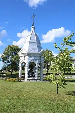
Saint-Claude, Quebec
Saint-Claude | |
|---|---|
 | |
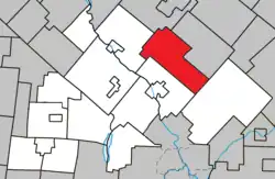 Location within Le Val-Saint-François RCM | |
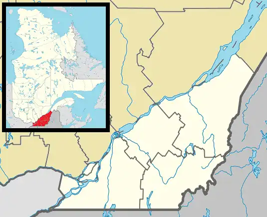 Saint-Claude Location in southern Quebec | |
| Coordinates: 45°40′N 71°59′W / 45.667°N 71.983°W[1] | |
| Country | |
| Province | |
| Region | Estrie |
| RCM | Le Val-Saint-François |
| Constituted | November 15, 1912 |
| Government | |
| • Mayor | Hervé Provencher |
| • Federal riding | Richmond—Arthabaska |
| • Prov. riding | Richmond |
| Area | |
• Total | 121.50 km2 (46.91 sq mi) |
| • Land | 118.65 km2 (45.81 sq mi) |
| Population (2011)[3] | |
• Total | 1,106 |
| • Density | 9.3/km2 (24/sq mi) |
| • Pop 2006-2011 | |
| • Dwellings | 551 |
| Time zone | UTC−5 (EST) |
| • Summer (DST) | UTC−4 (EDT) |
| Postal code(s) | |
| Area code | 819 |
| Highways | |
| Website | www |
Saint-Claude (French pronunciation: [sɛ̃ klod] ⓘ) is a municipality in Quebec.
Demographics
Population
| Year | Pop. | ±% |
|---|---|---|
| 1991 | 957 | — |
| 1996 | 1,004 | +4.9% |
| 2001 | 1,080 | +7.6% |
| 2006 | 1,104 | +2.2% |
| 2011 | 1,106 | +0.2% |
Language
Mother tongue (2011)[3]
| Language | Population | Pct (%) |
|---|---|---|
| French only | 1,070 | 96.8% |
| English only | 30 | 2.7% |
| English and French | 5 | 0.5% |
| Non-official languages | 0 | 0.0% |
See also
References
- ^ "Banque de noms de lieux du Québec: Reference number 55838". toponymie.gouv.qc.ca (in French). Commission de toponymie du Québec.
- ^ a b "Répertoire des municipalités: Geographic code 42100". www.mamh.gouv.qc.ca (in French). Ministère des Affaires municipales et de l'Habitation.
- ^ a b c "Saint-Claude, Quebec (Code 2442100) Census Profile". 2011 census. Government of Canada - Statistics Canada.
- ^ Statistics Canada: 1996, 2001, 2006, 2011 census
External links
![]() Media related to Saint-Claude, Quebec at Wikimedia Commons
Media related to Saint-Claude, Quebec at Wikimedia Commons
Adjacent Municipal Subdivisions | ||||||||||||||||
|---|---|---|---|---|---|---|---|---|---|---|---|---|---|---|---|---|
| ||||||||||||||||
| Cities & towns | |
|---|---|
| Municipalities | |
| Townships | |
| Villages | |
| |