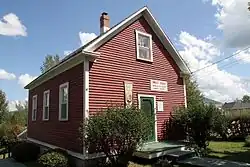
Saint-Christophe-d'Arthabaska
Saint-Christophe-d'Arthabaska | |
|---|---|
 | |
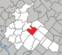 Location within Arthabaska RCM. | |
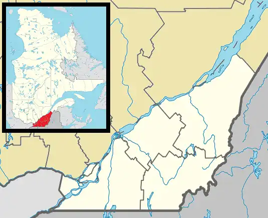 Saint-Christophe-d'Arthabaska Location in southern Quebec. | |
| Coordinates: 46°02′N 71°53′W / 46.033°N 71.883°W[1] | |
| Country | |
| Province | |
| Region | Centre-du-Québec |
| RCM | Arthabaska |
| Constituted | July 1, 1855 |
| Government | |
| • Mayor | Clémence Le May |
| • Federal riding | Richmond—Arthabaska |
| • Prov. riding | Arthabaska |
| Area | |
• Total | 69.20 km2 (26.72 sq mi) |
| • Land | 69 km2 (27 sq mi) |
| Population (2016)[3] | |
• Total | 3,021 |
| • Density | 43.8/km2 (113/sq mi) |
| • Pop 2011-2016 | |
| Postal code(s) | |
| Area code | 819 |
| Highways | |
| Website | www.saint-christophe -darthabaska.ca |
Saint-Christophe-d'Arthabaska (French pronunciation: [sɛ̃ kʁistɔf daʁtabaska]) is a parish municipality located in the Centre-du-Québec region of Quebec, Canada.
Demographics
In the 2021 Census of Population conducted by Statistics Canada, Saint-Christophe-d'Arthabaska had a population of 3,111 living in 1,178 of its 1,222 total private dwellings, a change of 3% from its 2016 population of 3,021. With a land area of 68.96 km2 (26.63 sq mi), it had a population density of 45.1/km2 (116.8/sq mi) in 2021.[4]
References
- ^ "Banque de noms de lieux du Québec: Reference number 55835". toponymie.gouv.qc.ca (in French). Commission de toponymie du Québec.
- ^ a b "Répertoire des municipalités: Geographic code 39060". www.mamh.gouv.qc.ca (in French). Ministère des Affaires municipales et de l'Habitation.
- ^ a b "Census Profile, 2016 Census - Saint-Christophe-d'Arthabaska, Paroisse (Municipalité de) [Census subdivision], Quebec and Saint-Raymond [Population centre], Quebec". 8 February 2017.
- ^ "Population and dwelling counts: Canada, provinces and territories, and census subdivisions (municipalities), Quebec". Statistics Canada. February 9, 2022. Retrieved August 29, 2022.
Places adjacent to Saint-Christophe-d'Arthabaska | ||||||||||||||||
|---|---|---|---|---|---|---|---|---|---|---|---|---|---|---|---|---|
| ||||||||||||||||
| Cities | |
|---|---|
| Municipalities | |
| Parishes | |
| Townships | |
| |