Saint-Christophe, Tarn
Saint-Christophe | |
|---|---|
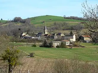 The church and surrounding buildings in Saint-Christophe | |
Location of Saint-Christophe | |
 Saint-Christophe  Saint-Christophe | |
| Coordinates: 44°09′09″N 2°02′56″E / 44.1525°N 2.0489°E | |
| Country | France |
| Region | Occitania |
| Department | Tarn |
| Arrondissement | Albi |
| Canton | Carmaux-2 Vallée du Cérou |
| Intercommunality | Carmausin-Ségala |
| Government | |
| • Mayor (2020–2026) | Thierry Maliet[1] |
Area 1 | 14.47 km2 (5.59 sq mi) |
| Population (2022)[2] | 131 |
| • Density | 9.1/km2 (23/sq mi) |
| Time zone | UTC+01:00 (CET) |
| • Summer (DST) | UTC+02:00 (CEST) |
| INSEE/Postal code | 81245 /81190 |
| Elevation | 156–484 m (512–1,588 ft) (avg. 400 m or 1,300 ft) |
| 1 French Land Register data, which excludes lakes, ponds, glaciers > 1 km2 (0.386 sq mi or 247 acres) and river estuaries. | |
Saint-Christophe (French pronunciation: [sɛ̃ kʁistɔf]; Languedocien: Sant Cristòfol) is a commune in the Tarn department in southern France. In 1973 it absorbed the former commune Narthoux.[3]
See also
References
- ^ "Répertoire national des élus: les maires". data.gouv.fr, Plateforme ouverte des données publiques françaises (in French). 2 December 2020.
- ^ "Populations de référence 2022" (in French). The National Institute of Statistics and Economic Studies. 19 December 2024.
- ^ Modifications aux circonscriptions administratives territoriales (fusion de communes), Journal officiel de la République française n° 0008, 10 January 1973, pp. 479-480.
Wikimedia Commons has media related to Saint-Christophe (Tarn).