Sacaton Flats Village, Arizona
Sacaton Flats Village, Arizona
O'odham: Ha:shañ Ke:k | |
|---|---|
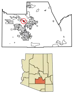 Location of Sacaton Flats Village in Pinal County, Arizona. | |
 Sacaton Flats Village, Arizona Location in the United States | |
| Coordinates: 33°16′34″N 112°10′1″W / 33.27611°N 112.16694°W | |
| Country | United States |
| State | Arizona |
| County | Pinal |
| Area | |
• Total | 6.65 sq mi (17.22 km2) |
| • Land | 6.65 sq mi (17.22 km2) |
| • Water | 0.00 sq mi (0.00 km2) |
| Population (2020) | |
• Total | 576 |
| • Density | 86.66/sq mi (33.46/km2) |
| Time zone | UTC-7 (MST (no DST)) |
| FIPS code | 04-61800 |
Sacaton Flats Village (O'odham: Ha:shañ Ke:k) is a census-designated place (CDP) in Pinal County, Arizona, United States, located in the Gila River Indian Community. The population was 621 at the 2010 census.
Demographics
| Census | Pop. | Note | %± |
|---|---|---|---|
| 2020 | 576 | — | |
| U.S. Decennial Census[2] | |||
As of the census[3] of 2010, there were 541 people living in the CDP. The population density was 86.8 people per square mile. The racial makeup of the CDP was 96% Native American, 1% White, <1% Black or African American, and 3% from two or more races. 12% of the population were Hispanic or Latino of any race.
Notes
- ^ "2020 U.S. Gazetteer Files". United States Census Bureau. Retrieved October 29, 2021.
- ^ "Census of Population and Housing". Census.gov. Retrieved June 4, 2016.
- ^ United States Census
Municipalities and communities of Pinal County, Arizona, United States | ||
|---|---|---|
| Cities | 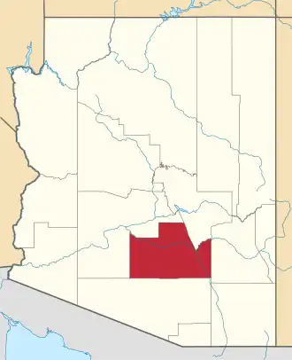 | |
| Towns | ||
| CDPs |
| |
| Populated places | ||
| Indian reservations | ||
| Ghost towns | ||
| Footnotes | ‡This populated place also has portions in an adjacent county or counties | |