Sơn Trà district
Sơn Trà district
Quận Sơn Trà District III(Quận III) | |
|---|---|
 | |
 Seal | |
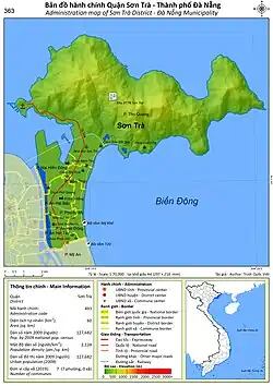 Administration map of the district in Da Nang | |
| Country | |
| Region | South Central Coast |
| Municipality | Da Nang |
| Capital | An Hai Tay |
| Area | |
• Total | 20 sq mi (60 km2) |
| Population (2018) | |
• Total | 173,455 |
| Time zone | UTC+7 (Indochina Time) |
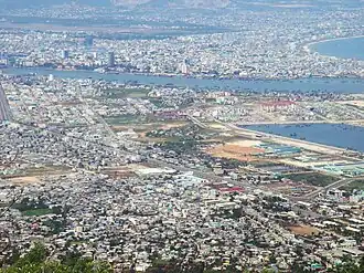
Sơn Trà is an urban district (quận) of Da Nang in the South Central Coast region of Vietnam. As of 2003 the district had a population of 112,196. The district covers an area of 60 km².[1] The district is bounded by ocean to the north and east, the Hàn River to the west, and Ngũ Hành Sơn district to the south. Sơn Trà Mountain occupies a large portion of the district.

The district is divided into 7 wards (phường):
- An Hải Bắc
- An Hải Đông
- An Hải Tây
- Mân Thái
- Nại Hiên Đông
- Phước Mỹ
- Thọ Quang
The district capital lies at An Hải Tây ward.
References
- ^ "Districts of Vietnam". Statoids. Retrieved March 20, 2009.
16°06′58″N 108°16′37″E / 16.116°N 108.277°E
Districts of the South Central Coast of Vietnam | ||
|---|---|---|
| Da Nang city | 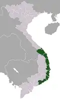 | |
| Bình Định province | ||
| Bình Thuận province | ||
| Khánh Hòa province |
| |
| Ninh Thuận province | ||
| Phú Yên province | ||
| Quảng Nam province | ||
| Quảng Ngãi province | ||
※ denotes provincial seat. / § Sovereignty over the Hoàng Sa and Trường Sa archipelagoes is disputed as of 22 August 2025. | ||