Rucmanci
Rucmanci | |
|---|---|
 Rucmanci Location in Slovenia | |
| Coordinates: 46°29′25.35″N 16°1′12.38″E / 46.4903750°N 16.0201056°E | |
| Country | |
| Traditional region | Styria |
| Statistical region | Drava |
| Municipality | Sveti Tomaž |
| Area | |
• Total | 4.74 km2 (1.83 sq mi) |
| Elevation | 301.4 m (988.8 ft) |
| Population (2002) | |
• Total | 231 |
| [1] | |
Rucmanci (pronounced [ˈɾuːtsmantsi], German: Rutzmanetz[2]) is a settlement in the Slovene Hills (Slovene: Slovenske gorice) in the Municipality of Sveti Tomaž in northeastern Slovenia. The area is part of the traditional region of Styria and is now included in the Drava Statistical Region.[3]
The village chapel-shrine with a belfry was built in 1905.[4]
References
- ^ Statistical Office of the Republic of Slovenia
- ^ Leksikon občin kraljestev in dežel zastopanih v državnem zboru, vol. 4: Štajersko. Vienna: C. Kr. Dvorna in Državna Tiskarna. 1904. p. 230.
- ^ Sveti Tomaž municipal site
- ^ Slovenian Ministry of Culture register of national heritage reference number 20155
External links
| Settlements | 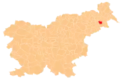 | |
|---|---|---|
| Landmarks | ||