Roxa
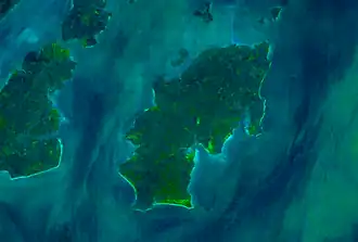 Satellite view | |
 | |
 Roxa (Canhabaque) | |
| Geography | |
|---|---|
| Location | Atlantic Ocean |
| Coordinates | 11°14′40″N 15°43′25″W / 11.24441°N 15.72349°W |
| Archipelago | Bissagos Islands |
| Area | 111 km2 (43 sq mi) |
| Length | 20 km (12 mi) |
| Width | 11 km (6.8 mi) |
| Administration | |
Guinea-Bissau | |
| Demographics | |
| Population | 2,478 (2009)[1] |
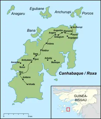
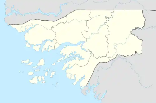
Roxa[2][3] or Canhabaque[1] is an island in the Bissagos Islands, Guinea-Bissau. It is part of the Bolama Region and Bubaque sector. Its area is 111 square kilometres (43 sq mi);[3] it is 20 kilometres (12 mi) long and 11 kilometres (6.8 mi) wide. The island has a population of 2,478 (2009 census), divided among the villages Ambuduco, Ampucute, Ancanhozinho, Indenazinho, Ancaguine, Ancatipe, Angaura, Indena Grande, Ga-Cote, Inore, Ambena, Bine, Inhoda, Idjoue, Eboco, Meneque, Ancanam, Anghudjiga, Anghumba and Antchurupe.[1] There is a lighthouse on the east side of the island,[2] its focal height is 26 m (85 ft).[4]
References
- ^ a b c População por região, sector e localidades por sexo censo 2009, Instituto Nacional de Estatística Guiné-Bissau
- ^ a b Sailing Directions (Enroute), Pub. 143: West Coast of Europe and Northwest Africa (PDF). Sailing Directions. United States National Geospatial-Intelligence Agency. 2017. p. 302.
- ^ a b Roxa in the Catalogue of Islands at UNEP (United Nations Environment Program) - accessed 16 November 2018
- ^ Rowlett, Russ. "Lighthouses of Guinea-Bissau". The Lighthouse Directory. University of North Carolina at Chapel Hill.