Rivière de l'Est
| Rivière de l'Est | |
|---|---|
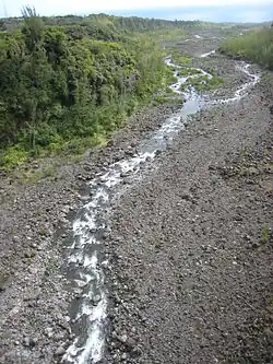 View from the bridge across Le Rivière de l'Est | |
| Location | |
| Country | France |
| Region | Réunion |
| Physical characteristics | |
| Source | |
| • elevation | 2,350 ft (720 m) |
| Mouth | |
• location | Indian Ocean |
• coordinates | 21°6′22″S 55°46′13″E / 21.10611°S 55.77028°E |
• elevation | sea level |
| Length | 21.2 km (13.2 mi) |
The Rivière de l'Est is a river on the Indian Ocean island of Réunion. It flows northeast from the southeast of the island, reaching the sea between the towns of Sainte-Anne and Sainte-Rose. It is 21.2 km (13.2 mi) long.[1]
The Rivière de l'Est flows down the slopes of the shield volcano Piton de la Fournaise from an elevation of 720 metres (2,350 ft) above sea level.
References