Rivière-Patapédia-Est
Rivière-Patapédia-Est | |
|---|---|
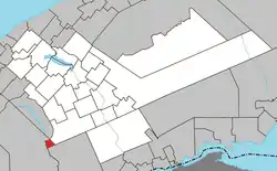 Location within La Matapédia RCM. | |
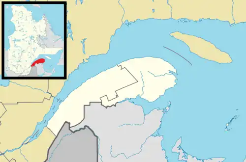 Rivière-Patapédia-Est Location in eastern Quebec. | |
| Coordinates: 48°07′N 67°39′W / 48.117°N 67.650°W[1] | |
| Country | |
| Province | |
| Region | Bas-Saint-Laurent |
| RCM | La Matapédia |
| Constituted | January 1, 1986 |
| Government | |
| • Federal riding | Rimouski—La Matapédia |
| • Prov. riding | Matane-Matapédia |
| Area | |
• Total | 15.50 km2 (5.98 sq mi) |
| • Land | 15.97 km2 (6.17 sq mi) |
| There is an apparent contradiction between two authoritative sources | |
| Population | |
• Total | 0 |
| • Density | 0.0/km2 (0/sq mi) |
| • Pop 2006-2011 | |
| • Dwellings | 0 |
| Time zone | UTC-5 (EST) |
| • Summer (DST) | UTC-4 (EDT) |
| Highways | No major routes |
Rivière-Patapédia-Est (French pronunciation: [ʁivjɛʁ patapedja ɛst]) is an unorganized territory in the Bas-Saint-Laurent region of Quebec, Canada.
It is named after the East Patapedia River that forms the territory's western boundary. This river is the main outlet of Lake Supérieur and a tributary of the Patapédia River.
Demographics
Population trend:[4]
- Population in 2011: 0
- Population in 2006: 0
- Population in 2001: 0
- Population in 1996: 0
- Population in 1991: 0
See also
References
- ^ "Banque de noms de lieux du Québec: Reference number 149688". toponymie.gouv.qc.ca (in French). Commission de toponymie du Québec.
- ^ a b "Rivière-Patapédia-Est". Répertoire des municipalités (in French). Ministère des Affaires municipales, des Régions et de l'Occupation du territoire. Retrieved 2012-02-06.
- ^ a b "Rivière-Patapédia-Est census profile". 2011 Census data. Statistics Canada. Retrieved 2012-02-06.
- ^ Statistics Canada: 1996, 2001, 2006, 2011 census
Adjacent Municipal Subdivisions | ||||||||||||||||
|---|---|---|---|---|---|---|---|---|---|---|---|---|---|---|---|---|
| ||||||||||||||||
| Cities & towns | |
|---|---|
| Municipalities | |
| Parishes | |
| Villages | |
| Unorganized territories | |
| |