Rittershoffen
Rittershoffen
Ritterschoffe | |
|---|---|
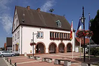 The town hall in Rittershoffen | |
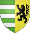 Coat of arms | |
Location of Rittershoffen | |
 Rittershoffen  Rittershoffen | |
| Coordinates: 48°54′15″N 7°57′08″E / 48.9042°N 7.9522°E | |
| Country | France |
| Region | Grand Est |
| Department | Bas-Rhin |
| Arrondissement | Haguenau-Wissembourg |
| Canton | Wissembourg |
| Government | |
| • Mayor (2020–2026) | Jean-Bernard Weigel[1] |
Area 1 | 12.13 km2 (4.68 sq mi) |
| Population (2022)[2] | 914 |
| • Density | 75/km2 (200/sq mi) |
| Time zone | UTC+01:00 (CET) |
| • Summer (DST) | UTC+02:00 (CEST) |
| INSEE/Postal code | 67404 /67690 |
| Elevation | 120–179 m (394–587 ft) |
| 1 French Land Register data, which excludes lakes, ponds, glaciers > 1 km2 (0.386 sq mi or 247 acres) and river estuaries. | |
Rittershoffen is a commune in the Bas-Rhin department in Grand Est in north-eastern France.[3] The commune was the scene of fierce fighting during Operation Nordwind in January 1945.
See also
References
- ^ "Répertoire national des élus: les maires". data.gouv.fr, Plateforme ouverte des données publiques françaises (in French). 2 December 2020.
- ^ "Populations de référence 2022" (in French). The National Institute of Statistics and Economic Studies. 19 December 2024.
- ^ INSEE commune file
Wikimedia Commons has media related to Rittershoffen.