Rahata taluka
Rahata taluka | |
|---|---|
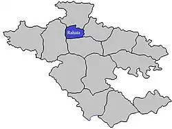 Location of Rahata in Ahmednagar district in Maharashtra | |
| Country | |
| State | Maharashtra |
| District | Ahmednagar district |
| Headquarters | Rahata |
| Area | |
• Total | 759.19 km2 (293.12 sq mi) |
| Population (2011) | |
• Total | 320,485 |
| • Density | 420/km2 (1,100/sq mi) |
| Demographics | |
| • Literacy % | 68.16 |
Rahata taluka, is a taluka in Shrirampur subdivision of Ahmednagar district in Maharashtra State of India.[1]
Area
The table below shows area of the taluka by land type.[2]
| Type of Land | Area (km2) | % of Total Area |
|---|---|---|
| Agriculture | 689.39 | 90.81 |
| Forest | 16.13 | 2.12 |
| Other | 53.67 | 7.07 |
| Total | 759.19 | 100 |
Villages
There are around 60 villages in Rahata taluka. For list of villages see Villages in Rahata taluka.
Population
Rahata taluka has a population of 320,485 according to the 2011 census. Rahata had a literacy rate of 82.08% and a sex ratio of 940 females per 1000 males. 58,339 (18.20%) live in urban areas. Scheduled Castes and Scheduled Tribes make up 17.14% and 6.28% of the population respectively.[4]
At the time of the 2011 Census of India, 87.94% of the population in the district spoke Marathi, 6.58% Hindi and 2.36% Urdu as their first language.[5]
Rain Fall
The Table below details of rainfall from year 1981 to 2004.[6]
| Year | Rainfall (mm) |
|---|---|
| 2000 | 525 |
| 2001 | 413 |
| 2002 | 385 |
| 2003 | 249 |
| 2004 | 491 |
See also
References
- ^ Talukas in Ahmednagar district
- ^ Talukas geographic information
- ^ "Table C-01 Population by Religion: Maharashtra". censusindia.gov.in. Registrar General and Census Commissioner of India. 2011.
- ^ "District Census Hand Book – Ahmednagar" (PDF). Census of India. Registrar General and Census Commissioner of India.
- ^ a b "Table C-16 Population by Mother Tongue: Maharashtra". censusindia.gov.in. Registrar General and Census Commissioner of India.
- ^ Rainfall information of Ahemadnagar district
Ahmednagar district topics | ||
|---|---|---|
| History | .svg.png) | |
| Geography | ||
| Talukas | ||
| Cities and towns | ||
| Monuments | ||
| Education | ||
| Lok Sabha constituencies | ||
| Vidhan Sabha constituencies | ||
| Dams in District | ||