Quintanilla San García
Quintanilla San García | |
|---|---|
Municipality and town | |
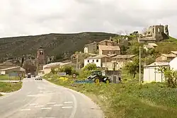 View of Quintanilla San García, 2010 | |
 Coat of arms | |
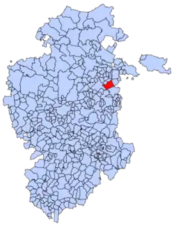 Municipal location of Quintanilla San García in Burgos province | |
| Coordinates: 42°33′00″N 3°11′00″W / 42.5500°N 3.1833°W | |
| Country | Spain |
| Autonomous community | |
| Province | |
| Comarca | La Bureba |
| Area | |
• Total | 45.75 km2 (17.66 sq mi) |
| Elevation | 725 m (2,379 ft) |
| Population (2018)[1] | |
• Total | 87 |
| • Density | 1.9/km2 (4.9/sq mi) |
| Time zone | UTC+1 (CET) |
| • Summer (DST) | UTC+2 (CEST) |
| Postal code | 09271 |
| Website | http://www.quintanillasangarcia.es/ |
Quintanilla San García is a municipality and town located in the province of Burgos, Castile and León, Spain. According to the 2013 census (INE), the municipality has a population of 101 inhabitants.
References
- ^ Municipal Register of Spain 2018. National Statistics Institute.