Quebec Route 1
.svg.png) Route 1 | ||||
|---|---|---|---|---|
 | ||||
| Route information | ||||
| Length | 676 km (420 mi) | |||
| Major junctions | ||||
| West end | ||||
| ||||
| East end | ||||
| Location | ||||
| Country | Canada | |||
| Province | Quebec | |||
| Major cities | Montreal, Sherbrooke, Quebec City | |||
| Highway system | ||||
| ||||
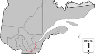
Route 1 was a previous number used for a major highway in the Canadian province of Quebec. The highway stretched from Montreal, through the Eastern Townships and the city of Sherbrooke, to Quebec City.[1][2][3] Route 1 was approximately 676 km (420 mi) long.
In the mid-1970s, as part of Quebec's renumbering scheme, Route 1 was replaced by the following routes:
| Route | Length (km) | Length (mi) | From | To | Notes |
|---|---|---|---|---|---|
| 3 | 2 | Montréal | Montréal-Sud | Crosses the Jacques Cartier Bridge; cosigned with former Route 5.[4] | |
| 4 | 2 | Montréal-Sud | Longueuil | Cosigned with former Route 3.[1] | |
| Chambly Road | 12 | 7 | Longueuil | Saint-Hubert | No longer carries a route number. |
| 317 | 197 | Saint-Hubert | Vallée-Jonction | ||
| 285 | 177 | Vallée-Jonction | Saint-Maxime | ||
| 31 | 19 | Saint-Maxime | Saint-Étienne-de-Lauzon | ||
| 12 | 7 | Saint-Étienne-de-Lauzon | Lévis | ||
| 12 | 7 | Lévis | Quebec City (downtown) |
Crosses the Quebec Bridge. |
References
- ^ a b The H.M. Gousha Company (1950). "Metropolitan District of Montreal" (Map). Shell Street Guide and Metropolitan Map of Montreal. The Shell Oil Company. §§ C-6, C-7, C-8, D-6.
- ^ The H.M. Gousha Company (1955). Shell Map of Quebec and Maritime Provinces (Map). The Shell Oil Company. §§ D-9, E-9, E-10, F-9, G-5, G-6, G-7, G-8, G-9.
- ^ The H.M. Gousha Company (1955). "Quebec" (Map). Shell Map of Quebec and Maritime Provinces. The Shell Oil Company.
- ^ The H.M. Gousha Company (1950). "Street Map of Montreal" (Map). Shell Street Guide and Metropolitan Map of Montreal. The Shell Oil Company. §§ G-8, H-8.