Pujini Ruins
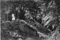 The stairway to the rampart, Pujini ruins, Pemba South. | |
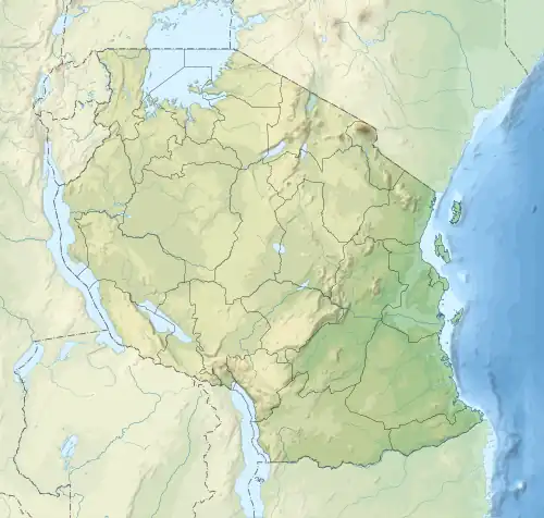 Shown within Tanzania | |
| Location | Chake Chake District, Pemba South Region, |
|---|---|
| Coordinates | 5°19′40.8″S 39°47′4.56″E / 5.328000°S 39.7846000°E |
| Type | Settlement |
| History | |
| Material | Coral rag |
| Founded | 12-14th century CE |
| Abandoned | 17th century CE |
| Cultures | Swahili |
| Site notes | |
| Ownership | Tanzanian Government |
| Management | Antiquities Division, Ministry of Natural Resources and Tourism [1] |
| Public access | yes |
| Architecture | |
| Architectural styles | Swahili & Islamic |
| Official name | Pujini Ruins Historic Site |
| Type | Cultural |
| inactive excavation | |
Pujini Ruins (Magofu ya mji wa kale wa Pujini in Swahili ) is a medieval historic site next to the village of Pujini located in Chake Chake District of Pemba South Region.[2] There used to be a fortified palace at the site, only ruins of the walls remain. The palace is believed to have been of Mkame Mdume.[3][4] Its one of several National Historic Sites on the island of Pemba including Chambani and Ras Mkumbuu.
See also
- Historic Swahili Settlements
- Kunduchi Ruins
- Kimbiji Ruins
- Tongoni Ruins
- Msuka Mjini Ruins
- Kichokochwe Ruins
References
- ^ "Antiquities Division". Ministry of Natural Resources and Tourism Tanzania. Archived from the original on 2022-08-03. Retrieved 21 July 2022.
- ^ Spear, Thomas (January 2000). "Swahili History and Society to 1900: A Classified Bibliography". History in Africa. 27: 339–373. doi:10.2307/3172120. JSTOR 3172120. S2CID 161594711.
- ^ LaViolette, Adria; Fleisher, Jeffrey (2009). "The Urban History of a Rural Place: Swahili Archaeology on Pemba Island, Tanzania, 700-1500 AD". The International Journal of African Historical Studies. 42 (3): 433–455. JSTOR 40646777.
- ^ Ingrams, William Harold (1800). The chief's trumpet or sacred horn in East Africa. JSTOR 60230294. OCLC 656511131.