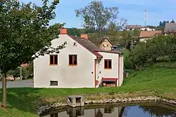
Proruby
Proruby | |
|---|---|
 Municipal office | |
 Proruby Location in the Czech Republic | |
| Coordinates: 50°4′14″N 16°17′43″E / 50.07056°N 16.29528°E | |
| Country | |
| Region | Hradec Králové |
| District | Rychnov nad Kněžnou |
| First mentioned | 1497 |
| Area | |
• Total | 2.53 km2 (0.98 sq mi) |
| Elevation | 480 m (1,570 ft) |
| Population (2025-01-01)[1] | |
• Total | 58 |
| • Density | 23/km2 (59/sq mi) |
| Time zone | UTC+1 (CET) |
| • Summer (DST) | UTC+2 (CEST) |
| Postal code | 517 41 |
| Website | proruby |
Proruby is a municipality and village in Rychnov nad Kněžnou District in the Hradec Králové Region of the Czech Republic. It has about 60 inhabitants.
Demographics
| Year | Pop. | ±% |
|---|---|---|
| 1869 | 359 | — |
| 1880 | 343 | −4.5% |
| 1890 | 315 | −8.2% |
| 1900 | 308 | −2.2% |
| 1910 | 301 | −2.3% |
| 1921 | 277 | −8.0% |
| 1930 | 261 | −5.8% |
| 1950 | 204 | −21.8% |
| 1961 | 148 | −27.5% |
| 1970 | 115 | −22.3% |
| 1980 | 83 | −27.8% |
| 1991 | 55 | −33.7% |
| 2001 | 52 | −5.5% |
| 2011 | 58 | +11.5% |
| 2021 | 49 | −15.5% |
| Source: Censuses[2][3] | ||
References
- ^ "Population of Municipalities – 1 January 2025". Czech Statistical Office. 2025-05-16.
- ^ "Historický lexikon obcí České republiky 1869–2011" (in Czech). Czech Statistical Office. 2015-12-21.
- ^ "Population Census 2021: Population by sex". Public Database. Czech Statistical Office. 2021-03-27.
External links
Wikimedia Commons has media related to Proruby.