Portland, Ouray County, Colorado
Portland, Colorado | |
|---|---|
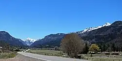 Looking south along U.S. Route 550 in Portland. | |
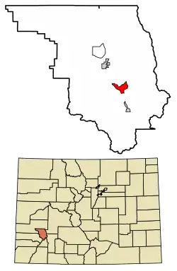 Location of the Portland CDP in Ouray County, Colorado. | |
 Portland Location of the Portland CDP in the United States. | |
| Coordinates: 38°05′21″N 107°41′43″W / 38.08917°N 107.69528°W[1] | |
| Country | United States |
| State | Colorado |
| County | Ouray |
| Government | |
| • Type | unincorporated community |
| Area | |
• Total | 3.202 sq mi (8.293 km2) |
| • Land | 3.202 sq mi (8.293 km2) |
| • Water | 0.000 sq mi (0.000 km2) |
| Elevation | 8,124 ft (2,476 m) |
| Population | |
• Total | 136 |
| • Density | 42/sq mi (16/km2) |
| Time zone | UTC-7 (MST) |
| • Summer (DST) | UTC-6 (MDT) |
| ZIP Code[4] | Ridgway 81432 |
| Area code | 970 |
| GNIS feature ID | 2583285[1] |
Portland is a census-designated place (CDP) located in and governed by Ouray County, Colorado, United States. The CDP is a part of the Montrose, CO Micropolitan Statistical Area. The population of the Portland CDP was 136 at the United States Census 2020.[3] The Ridgway post office (Zip Code 81432) serves the area.[4]
Geography
Portland is located between Ridgway and Ouray.
The Portland CDP has an area of 2,049 acres (8.293 km2), all land.[2]
Demographics
The United States Census Bureau initially defined the Portland CDP for the United States Census 2010.
| Year | Pop. | ±% |
|---|---|---|
| 2010 | 135 | — |
| 2020 | 136 | +0.7% |
| Source: United States Census Bureau | ||
See also
References
- ^ a b c d U.S. Geological Survey Geographic Names Information System: Portland, Ouray County, Colorado
- ^ a b "State of Colorado Census Designated Places - BAS20 - Data as of January 1, 2020". United States Census Bureau. Retrieved December 26, 2020.
- ^ a b United States Census Bureau. "Portland CDP, Colorado". Retrieved April 13, 2023.
- ^ a b "Zip Code 81432 Map and Profile". zipdatamaps.com. 2020. Retrieved December 26, 2020.
External links
Wikimedia Commons has media related to Portland, Colorado.
Municipalities and communities of Ouray County, Colorado, United States | ||
|---|---|---|
| City |  | |
| Town | ||
| CDPs | ||
| Unincorporated communities | ||
| Ghost towns | ||