Polk Township, Nodaway County, Missouri
Polk Township | |
|---|---|
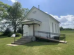 West Union Privative Baptist Church in eastern Polk Township | |
 | |
| Coordinates: 40°21′15″N 94°51′53″W / 40.3541399°N 94.8647183°W | |
| Country | United States |
| State | Missouri |
| County | Nodaway |
| Erected | 1845 |
| Area | |
• Total | 120.56 sq mi (312.2 km2) |
| • Land | 120.32 sq mi (311.6 km2) |
| • Water | 0.24 sq mi (0.6 km2) 0.2% |
| Elevation | 1,096 ft (334 m) |
| Population | |
• Total | 14,200 |
| • Density | 118.0/sq mi (45.6/km2) |
| FIPS code | 29-14758808[1] |
| GNIS feature ID | 767095[2] |
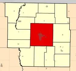
Polk Township is a township in Nodaway County, Missouri, United States.[2] At the 2020 census, its population was 14,200.[3] It is by far the largest township in land area containing 121 sections.[4] It is also the most populated township. containing the county seat Maryville in its center. Two other platted towns exist in the township, Wilcox and Bedison, the former being a Census-designated place and the latter being an extinct community.
Polk Township was erected in 1845. and named after President James K. Polk.[5] In 1861 and 1866 boundary changes were made.[4]
References
- ^ a b "MO TIGER County Subdivisions". Missouri Spatial Data Infomration Service. United States Census Bureau. Retrieved April 21, 2025.
- ^ a b c U.S. Geological Survey Geographic Names Information System: Polk Township, Nodaway County, Missouri
- ^ a b "Census 2020 DHC Extract Assistance". Missouri Census Data Center. Retrieved April 21, 2025.
- ^ a b "Past and present of Nodaway County, Missouri - Volume 1". B.F. Bowen & Company. Retrieved November 3, 2024.
- ^ "Nodaway County Place Names, 1928–1945". The State Historical Society of Missouri. Archived from the original on June 24, 2016. Retrieved November 24, 2016.
External links
- USGS Map of: Maryville West, MO. Archived from the original
Municipalities and communities of Nodaway County, Missouri, United States | ||
|---|---|---|
| Cities | 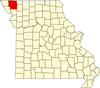 | |
| Villages | ||
| Townships | ||
| Unincorporated Communities | ||
| Extinct Hamlets | ||