Pobit Kamak, Pazardzhik Province
Pobit Kamak
Побит камък | |
|---|---|
Village | |
 | |
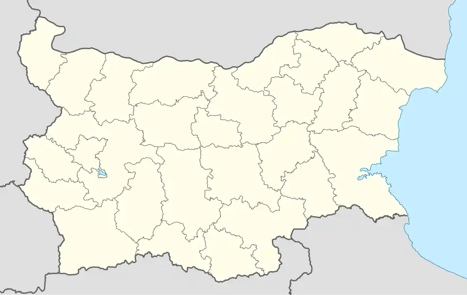 Pobit Kamak Location of Pobit Kamak | |
| Coordinates: 41°49′28.16″N 23°53′8.1″E / 41.8244889°N 23.885583°E | |
| Country | |
| Provinces (Oblast) | Pazardzhik Province |
| Municipality (Obshtina) | Sarnitsa Municipality |
| Area | |
• Total | 47.684 km2 (18.411 sq mi) |
| Elevation | 1,271 m (4,170 ft) |
| Population | |
• Total | 641 |
| • Density | 13/km2 (35/sq mi) |
| Time zone | UTC+2 (EET) |
| • Summer (DST) | UTC+3 (EEST) |
| Postal Code | 4638 |
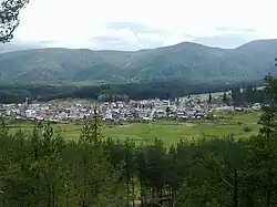
Pobit Kamak (Bulgarian: Побит камък, romanized: Pobit kamak) is a village located in Sarnitsa Municipality, Pazardzhik Province, Southern Bulgaria. The population is 641.[1]
Geography
The village is situated on the western Rhodopes, a mountainous region, encompassing it on all sides. It is surrounded by mountain hills - to the south-west Divite kozi, while to the south - the 1938 metres high Beslet Peak.
Religion
Islam is the predominant religion in the village.
References
- ^ "Население Село Побит камък". Guide Bulgaria (in Bulgarian). Retrieved 2022-12-21.
Capital: Sarnitsa | ||
| Villages |  | |
| Landmarks | ||
| Culture | ||
| Notable people | ||