Poříčí u Litomyšle
Poříčí u Litomyšle | |
|---|---|
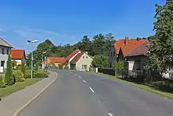 Main road | |
 Flag  Coat of arms | |
 Poříčí u Litomyšle Location in the Czech Republic | |
| Coordinates: 49°47′54″N 16°11′38″E / 49.79833°N 16.19389°E | |
| Country | |
| Region | Pardubice |
| District | Svitavy |
| First mentioned | 1361 |
| Area | |
• Total | 6.51 km2 (2.51 sq mi) |
| Elevation | 435 m (1,427 ft) |
| Population (2025-01-01)[1] | |
• Total | 528 |
| • Density | 81/km2 (210/sq mi) |
| Time zone | UTC+1 (CET) |
| • Summer (DST) | UTC+2 (CEST) |
| Postal code | 570 01 |
| Website | www |
Poříčí u Litomyšle is a municipality and village in Svitavy District in the Pardubice Region of the Czech Republic. It has about 500 inhabitants.
Poříčí u Litomyšle lies approximately 20 kilometres (12 mi) west of Svitavy, 41 km (25 mi) south-east of Pardubice, and 132 km (82 mi) east of Prague.
Administrative division
Poříčí u Litomyšle consists of three municipal parts (in brackets population according to the 2021 census):[2]
- Poříčí u Litomyšle (322)
- Mladočov (90)
- Zrnětín (93)
Demographics
| Year | Pop. | ±% |
|---|---|---|
| 1869 | 846 | — |
| 1880 | 826 | −2.4% |
| 1890 | 777 | −5.9% |
| 1900 | 728 | −6.3% |
| 1910 | 770 | +5.8% |
| 1921 | 700 | −9.1% |
| 1930 | 661 | −5.6% |
| 1950 | 552 | −16.5% |
| 1961 | 512 | −7.2% |
| 1970 | 473 | −7.6% |
| 1980 | 440 | −7.0% |
| 1991 | 393 | −10.7% |
| 2001 | 412 | +4.8% |
| 2011 | 456 | +10.7% |
| 2021 | 505 | +10.7% |
| Source: Censuses[3][4] | ||
References
- ^ "Population of Municipalities – 1 January 2025". Czech Statistical Office. 2025-05-16.
- ^ "Public Census 2021 – basic data". Public Database (in Czech). Czech Statistical Office. 2022.
- ^ "Historický lexikon obcí České republiky 1869–2011" (in Czech). Czech Statistical Office. 2015-12-21.
- ^ "Population Census 2021: Population by sex". Public Database. Czech Statistical Office. 2021-03-27.
External links
Wikimedia Commons has media related to Poříčí u Litomyšle.