Chersky Peak
| Chersky Peak | |
|---|---|
| Пик Черского / Хара-Болдог | |
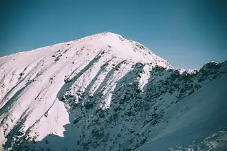 View of the peak in February | |
| Highest point | |
| Elevation | 2,090 m (6,860 ft)[1] |
| Prominence | 352 m (1,155 ft) |
| Coordinates | 51°30′56″N 103°37′33″E / 51.51556°N 103.62583°E[1] |
| Geography | |
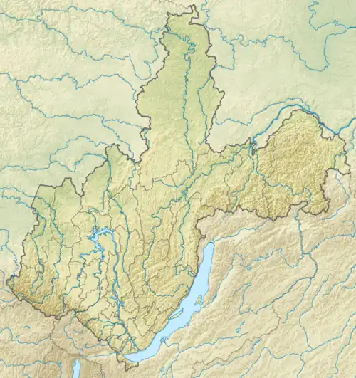 Chersky Peak Location in Irkutsk Oblast | |
| Location | Irkutsk Oblast Russian Far East |
| Parent range | Khamar-Daban, South Siberian Mountains |
Chersky Peak (Russian: Пик Черского; Buryat: Хара-Болдог) is a mountain in the Komarinsky Range, Khamar-Daban, Russian Federation.
This peak is named after Polish explorer Jan Czerski (1845–1892), who greatly contributed to the study of neighboring Lake Baikal.[2]
Geography
This 2,090 m high peak is one of the highest points of the Khamar-Daban Range, part of the South Siberian System of ranges. It rises in the Komarinsky subrange of the Khamar-Daban. Administratively the Chersky Peak is part of the Slyudyansky District, at the southern end of Irkutsk Oblast. Lake Serdtse is located below the southern slopes of the mountain.[3]
See also
References
- ^ a b "Pik Cherskogo". PeakVisor.
- ^ Природа Байкала - вершина Пик Черского (in Russian)
- ^ Google Earth
External links
 Media related to Chersky Peak at Wikimedia Commons