Pemagatsel
Pemagatsel | |
|---|---|
| Nickname: Khidung | |
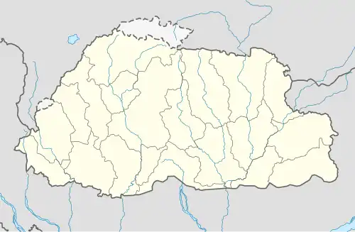 Pemagatsel Location in Bhutan | |
| Coordinates: 27°02′15″N 91°24′14″E / 27.03750°N 91.40389°E | |
| Country | |
| District | Pema Gatshel District |
| Government | |
| • Type | Constitutional democratic monarchy |
| Area | |
| • | 400 sq mi (1,000 km2) |
| Time zone | UTC+6 (BTT) |
| Area code | 07 |
Pemagatsel, also transliterated as Pemagatshel,[1] is a town in Pemagatshel District in eastern Bhutan.[2]
Climate
| Climate data for Pemagatshel, elevation 1,618 m (5,308 ft), (1996–2017 normals, extremes 2005–2017) | |||||||||||||
|---|---|---|---|---|---|---|---|---|---|---|---|---|---|
| Month | Jan | Feb | Mar | Apr | May | Jun | Jul | Aug | Sep | Oct | Nov | Dec | Year |
| Record high °C (°F) | 22.0 (71.6) |
24.0 (75.2) |
27.0 (80.6) |
27.0 (80.6) |
29.0 (84.2) |
30.0 (86.0) |
31.0 (87.8) |
28.5 (83.3) |
29.0 (84.2) |
28.5 (83.3) |
26.0 (78.8) |
22.0 (71.6) |
31.0 (87.8) |
| Mean daily maximum °C (°F) | 15.9 (60.6) |
17.4 (63.3) |
20.1 (68.2) |
22.2 (72.0) |
24.0 (75.2) |
24.9 (76.8) |
25.2 (77.4) |
25.3 (77.5) |
25.1 (77.2) |
23.8 (74.8) |
20.7 (69.3) |
17.8 (64.0) |
21.9 (71.4) |
| Daily mean °C (°F) | 10.4 (50.7) |
12.0 (53.6) |
14.9 (58.8) |
17.4 (63.3) |
19.6 (67.3) |
21.1 (70.0) |
21.5 (70.7) |
21.4 (70.5) |
20.8 (69.4) |
18.4 (65.1) |
14.9 (58.8) |
12.1 (53.8) |
17.0 (62.7) |
| Mean daily minimum °C (°F) | 4.8 (40.6) |
6.6 (43.9) |
9.7 (49.5) |
12.6 (54.7) |
15.1 (59.2) |
17.2 (63.0) |
17.8 (64.0) |
17.5 (63.5) |
16.5 (61.7) |
12.9 (55.2) |
9.0 (48.2) |
6.4 (43.5) |
12.2 (53.9) |
| Record low °C (°F) | −1.0 (30.2) |
−1.5 (29.3) |
3.0 (37.4) |
8.0 (46.4) |
11.5 (52.7) |
14.0 (57.2) |
15.0 (59.0) |
14.7 (58.5) |
11.5 (52.7) |
7.0 (44.6) |
2.0 (35.6) |
2.5 (36.5) |
−1.5 (29.3) |
| Average rainfall mm (inches) | 8.7 (0.34) |
25.5 (1.00) |
94.2 (3.71) |
141.4 (5.57) |
150.9 (5.94) |
328.0 (12.91) |
427.3 (16.82) |
290.3 (11.43) |
188.8 (7.43) |
99.6 (3.92) |
6.1 (0.24) |
3.5 (0.14) |
1,764.3 (69.45) |
| Average relative humidity (%) | 72.0 | 69.9 | 70.3 | 74.2 | 79.5 | 85.2 | 87.3 | 85.5 | 83.2 | 76.6 | 72.5 | 71.9 | 77.3 |
| Source: National Center for Hydrology and Meteorology[3] | |||||||||||||
References
- ^ see eg. https://www.drukgreen.bt/index.php/media-centre/news/external-news/256-daytime-black-out-in-east-and-central-region
- ^ "NGA GeoName Database". National Geospatial-Intelligence Agency. Archived from the original on 2008-06-08. Retrieved 2008-07-05.
- ^ "Climate Data Book of Bhutan, 2018" (PDF). National Center for Hydrology and Meteorology. Retrieved 20 February 2025.