Papetoai
Papetō'ai | |
|---|---|
 Moʻorea, the island on which Papetō'ai is located | |
 Location within French Polynesia | |
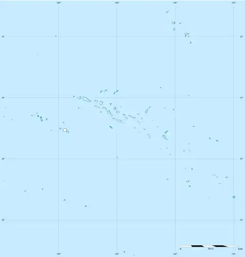
Location of Papetō'ai | |
| Coordinates: 17°29′44″S 149°52′22″W / 17.49556°S 149.87278°W | |
| Country | France |
| Overseas collectivity | French Polynesia |
| Subdivision | Windward Islands |
| Commune | Moʻorea-Maiʻao |
| Population (2022)[1] | 2,214 |
| Time zone | UTC−10:00 |
| Elevation | 18 m (59 ft) |
Papetoai (also spelled Papetō'ai) is an associated commune on the island of Mo'orea, in French Polynesia. It is part of the commune Moorea-Maiao. According to the 2022 census, it had a population of 2,214.[1]
Geography
Climate
Papetō'ai has a tropical rainforest climate (Köppen climate classification Af). The average annual temperature in Papetō'ai is 25.8 °C (78.4 °F). The average annual rainfall is 3,108.3 mm (122.37 in) with December as the wettest month. The temperatures are highest on average in March, at around 27.0 °C (80.6 °F), and lowest in August, at around 24.3 °C (75.7 °F). The highest temperature ever recorded in Papetō'ai was 37.6 °C (99.7 °F) on 26 March 2022; the coldest temperature ever recorded was 14.5 °C (58.1 °F) on 4 July 1998.
| Climate data for Papetō'ai (1991−2020 normals, extremes 1979−present) | |||||||||||||
|---|---|---|---|---|---|---|---|---|---|---|---|---|---|
| Month | Jan | Feb | Mar | Apr | May | Jun | Jul | Aug | Sep | Oct | Nov | Dec | Year |
| Record high °C (°F) | 36.5 (97.7) |
36.0 (96.8) |
37.6 (99.7) |
36.0 (96.8) |
36.2 (97.2) |
34.0 (93.2) |
32.5 (90.5) |
34.5 (94.1) |
34.5 (94.1) |
35.0 (95.0) |
34.5 (94.1) |
34.7 (94.5) |
37.6 (99.7) |
| Mean daily maximum °C (°F) | 30.7 (87.3) |
31.1 (88.0) |
31.6 (88.9) |
31.3 (88.3) |
30.3 (86.5) |
29.4 (84.9) |
29.0 (84.2) |
28.9 (84.0) |
29.3 (84.7) |
29.8 (85.6) |
30.3 (86.5) |
30.4 (86.7) |
30.2 (86.4) |
| Daily mean °C (°F) | 26.6 (79.9) |
26.8 (80.2) |
27.0 (80.6) |
26.8 (80.2) |
25.9 (78.6) |
24.9 (76.8) |
24.5 (76.1) |
24.3 (75.7) |
24.7 (76.5) |
25.3 (77.5) |
26.0 (78.8) |
26.3 (79.3) |
25.8 (78.4) |
| Mean daily minimum °C (°F) | 22.5 (72.5) |
22.5 (72.5) |
22.4 (72.3) |
22.2 (72.0) |
21.5 (70.7) |
20.5 (68.9) |
20.0 (68.0) |
19.8 (67.6) |
20.2 (68.4) |
20.9 (69.6) |
21.6 (70.9) |
22.3 (72.1) |
21.4 (70.5) |
| Record low °C (°F) | 18.4 (65.1) |
18.7 (65.7) |
19.5 (67.1) |
18.4 (65.1) |
17.4 (63.3) |
15.1 (59.2) |
14.5 (58.1) |
15.0 (59.0) |
16.0 (60.8) |
16.5 (61.7) |
17.4 (63.3) |
17.6 (63.7) |
14.5 (58.1) |
| Average precipitation mm (inches) | 410.1 (16.15) |
376.2 (14.81) |
277.9 (10.94) |
228.2 (8.98) |
205.5 (8.09) |
170.3 (6.70) |
139.2 (5.48) |
144.4 (5.69) |
183.0 (7.20) |
226.6 (8.92) |
272.6 (10.73) |
474.3 (18.67) |
3,108.3 (122.37) |
| Average precipitation days (≥ 1.0 mm) | 17.5 | 16.2 | 14.2 | 14.5 | 12.5 | 11.4 | 10.6 | 9.8 | 11.3 | 13.0 | 15.6 | 19.9 | 166.4 |
| Source: Météo-France[2] | |||||||||||||
References
- ^ a b "Les résultats du recensement de la population 2022 de Polynésie française" [Results of the 2022 population census of French Polynesia] (PDF) (in French). Institut de la statistique de la Polynésie française. January 2023.
- ^ "Fiche Climatologique Statistiques 1991-2020 et records" (PDF) (in French). Météo-France. Retrieved August 27, 2022.