Oudega, De Fryske Marren
Oudega
Aldegea | |
|---|---|
Village | |
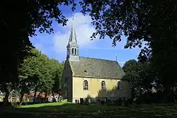 Oudega church | |
_wapen.svg.png) Coat of arms | |
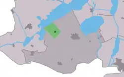 Location in the former Gaasterlân-Sleat municipality | |
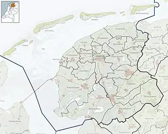 Oudega Location in the Netherlands  Oudega Oudega (Netherlands) | |
| Coordinates: 52°54′18″N 5°31′24″E / 52.90500°N 5.52333°E | |
| Country | |
| Province | |
| Municipality | |
| Area | |
• Total | 6.53 km2 (2.52 sq mi) |
| Elevation | −1.0 m (−3.3 ft) |
| Population (2021)[1] | |
• Total | 265 |
| • Density | 41/km2 (110/sq mi) |
| Postal code | 8582[1] |
| Dialing code | 0514 |
Oudega (West Frisian: Aldegea) is a small village in De Fryske Marren municipality in the province of Friesland, the Netherlands. It had a population of around 265 in 2017.[3]
History
It was first mentioned in 1412 as Oldegae, and means "old village".[4] The Dutch Reformed Church dates from 1850, and has been built on a terp (artificial living mound). In 1840, Oudega was home to 366 people.[5]
Before 2014, Oudega was part of the Gaasterlân-Sleat municipality and before 1984 it belonged to Hemelumer Oldeferd which was named Hemelumer Oldephaert & Noordwolde (H.O.N.). before 1956.[5]
Gallery
-
![Art by Evert van Hemert [nl]](./_assets_/Fiets_kunst_van_Evert_van_Hemert.JPG) Art by Evert van Hemert
Art by Evert van Hemert -
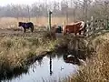 Ponies in Oudega
References
- ^ a b c "Kerncijfers wijken en buurten 2021". Central Bureau of Statistics. Retrieved 29 March 2022.
- ^ "Postcodetool for 8582KM". Actueel Hoogtebestand Nederland (in Dutch). Het Waterschapshuis. Retrieved 29 March 2022.
- ^ Kerncijfers wijken en buurten 2017 - CBS
- ^ "Oudega - (geografische naam)". Etymologiebank (in Dutch). Retrieved 29 March 2022.
- ^ a b "Oudega (Gaasterland)". Plaatsengids (in Dutch). Retrieved 29 March 2022.
Wikimedia Commons has media related to Oudega (De Fryske Marren).