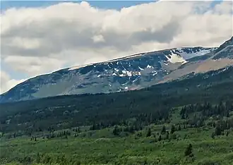
Otokomi Mountain
| Otokomi Mountain | |
|---|---|
 East aspect | |
| Highest point | |
| Elevation | 7,939 ft (2,420 m)[1] |
| Prominence | 415 ft (126 m)[1] |
| Coordinates | 48°43′30″N 113°32′11″W / 48.72500°N 113.53639°W[2] |
| Geography | |
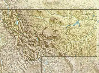 Otokomi Mountain Location in Montana  Otokomi Mountain Location in the United States | |
| Location | Glacier County, Montana, U.S. |
| Parent range | Lewis Range |
| Topo map | USGS Rising Sun MT |
| Climbing | |
| First ascent | Unknown |
| Easiest route | class 3 |
Otokomi Mountain (7,939 feet (2,420 m)) is located in the Lewis Range, Glacier National Park in the U.S. state of Montana.[3] Named for George Bird Grinnell's part-Blackfoot hunting partner named Otokomi which means "yellowfish'.[4] Otokomi Mountain is north of the Rising Sun Auto Camp and Saint Mary Lake.
See also
References
- ^ a b "Otokomi Mountain, Montana". Peakbagger.com. Retrieved May 27, 2018.
- ^ "Otokomi Mountain". Geographic Names Information System. United States Geological Survey, United States Department of the Interior. Retrieved May 27, 2018.
- ^ Rising Sun, MT (Map). TopoQwest (United States Geological Survey Maps). Retrieved May 27, 2018.
- ^ "Historic Place Names". Through the Years in Glacier National Park: An Administrative History. National Park Service. Retrieved May 27, 2018.