Okrouhlá (Česká Lípa District)
Okrouhlá | |
|---|---|
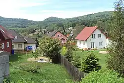 Family houses in Okrouhlá | |
_Flag.jpg) Flag _CoA.png) Coat of arms | |
 Okrouhlá Location in the Czech Republic | |
| Coordinates: 50°46′0″N 14°31′40″E / 50.76667°N 14.52778°E | |
| Country | |
| Region | Liberec |
| District | Česká Lípa |
| First mentioned | 1543 |
| Area | |
• Total | 4.24 km2 (1.64 sq mi) |
| Elevation | 385 m (1,263 ft) |
| Population (2025-01-01)[1] | |
• Total | 580 |
| • Density | 140/km2 (350/sq mi) |
| Time zone | UTC+1 (CET) |
| • Summer (DST) | UTC+2 (CEST) |
| Postal code | 473 01 |
| Website | www |
Okrouhlá is a municipality and village in Česká Lípa District in the Liberec Region of the Czech Republic. It has about 600 inhabitants.
Demographics
| Year | Pop. | ±% |
|---|---|---|
| 1869 | 681 | — |
| 1880 | 674 | −1.0% |
| 1890 | 720 | +6.8% |
| 1900 | 680 | −5.6% |
| 1910 | 646 | −5.0% |
| 1921 | 574 | −11.1% |
| 1930 | 644 | +12.2% |
| 1950 | 389 | −39.6% |
| 1961 | 413 | +6.2% |
| 1970 | 352 | −14.8% |
| 1980 | 341 | −3.1% |
| 1991 | 401 | +17.6% |
| 2001 | 470 | +17.2% |
| 2011 | 508 | +8.1% |
| 2021 | 537 | +5.7% |
| Source: Censuses[2][3] | ||
References
- ^ "Population of Municipalities – 1 January 2025". Czech Statistical Office. 2025-05-16.
- ^ "Historický lexikon obcí České republiky 1869–2011" (in Czech). Czech Statistical Office. 2015-12-21.
- ^ "Population Census 2021: Population by sex". Public Database. Czech Statistical Office. 2021-03-27.
External links
Wikimedia Commons has media related to Okrouhlá (Česká Lípa District).