Pryvitne, Zaporizhzhia Raion
Pryvitne
Привітне | |
|---|---|
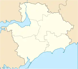 Pryvitne Location of Pryvitne in Zaporizhzhia Oblast | |
| Coordinates: 48°00′00″N 35°06′36″E / 48.00000°N 35.11000°E | |
| Country | |
| Province | Zaporizhzhia Oblast |
| District | Zaporizhzhia Raion |
| Council | Avhustynivka Rural Council |
| Founded | 1928 |
| Area | |
• Total | 7.63 km2 (2.95 sq mi) |
| Elevation | 59 m (194 ft) |
| Population (2001)[1] | |
• Total | 190 |
| • Density | 25/km2 (64/sq mi) |
| Time zone | UTC+2 (EET) |
| • Summer (DST) | UTC+3 (EEST) |
| Postal code | 70406 |
| Area code | +380 61 |
| Website | http://rada.gov.ua/ |
Pryvitne (Ukrainian: Привітне) is a village (a selo) in the Zaporizhzhia Raion (district) of Zaporizhzhia Oblast in southern Ukraine. Its population was 190 in the 2001 Ukrainian Census.[2] Administratively, it belongs to the Avhustynivka Rural Council, a local government area.[2]
The settlement was first founded in 1928 as Nova Oleksandrivka (Ukrainian: Нова Олександрівка); in 1967, it was renamed to Pryvitne.[2]
On September 19, 2022, the Russian military launched a rocket attack on the village and 12 homes were damaged.
References
- ^ "Pryvitne (Zaporizhzhia Oblast, Zaporizhzhia Raion)". weather.in.ua. Retrieved 16 January 2015.
- ^ a b c "Pryvitne, Zaporizhzhia Oblast, Zaporizhzhia Raion". Regions of Ukraine and their Structure (in Ukrainian). Verkhovna Rada of Ukraine. Retrieved 16 January 2015.
| Cities |  | |
|---|---|---|
| Rural settlements | ||
| Villages |
| |