Northeast Township, Orange County, Indiana
Northeast Township | |
|---|---|
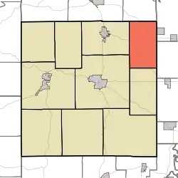 Location in Orange County | |
| Coordinates: 38°37′01″N 86°22′31″W / 38.61694°N 86.37528°W | |
| Country | |
| State | |
| County | Orange |
| Government | |
| • Type | Indiana township |
| Area | |
• Total | 28.7 sq mi (74 km2) |
| • Land | 28.63 sq mi (74.2 km2) |
| • Water | 0.08 sq mi (0.2 km2) 0.28% |
| Elevation | 702 ft (214 m) |
| Population (2020) | |
• Total | 493 |
| • Density | 17/sq mi (6.6/km2) |
| Time zone | UTC-5 (Eastern (EST)) |
| • Summer (DST) | UTC-4 (EDT) |
| ZIP codes | 47108, 47452 |
| Area codes | 812, 930 |
| GNIS feature ID | 452423 |
Northeast Township is one of ten townships in Orange County, Indiana, United States. As of the 2020 census, its population was 493 and it contained 222 housing units.[1]
| Census | Pop. | Note | %± |
|---|---|---|---|
| 1890 | 898 | — | |
| 1900 | 965 | 7.5% | |
| 1910 | 835 | −13.5% | |
| 1920 | 761 | −8.9% | |
| 1930 | 702 | −7.8% | |
| 1940 | 743 | 5.8% | |
| 1950 | 655 | −11.8% | |
| 1960 | 700 | 6.9% | |
| 1970 | 626 | −10.6% | |
| 1980 | 594 | −5.1% | |
| 1990 | 548 | −7.7% | |
| 2000 | 578 | 5.5% | |
| 2010 | 549 | −5.0% | |
| 2020 | 493 | −10.2% | |
| Source: US Decennial Census[2] | |||
Geography
According to the 2010 census, the township has a total area of 28.7 square miles (74 km2), of which 28.63 square miles (74.2 km2) (or 99.76%) is land and 0.08 square miles (0.21 km2) (or 0.28%) is water.[3]
Unincorporated towns
- Bromer at 38°35′37″N 86°20′09″W / 38.593667°N 86.335818°W
- Leipsic at 38°40′16″N 86°22′11″W / 38.671165°N 86.369709°W
- Pumpkin Center at 38°35′22″N 86°21′52″W / 38.589500°N 86.36443°W
(This list is based on USGS data and may include former settlements.)
Cemeteries
The township contains these four cemeteries: Edward, Freed, Freedom and Trimble.
Major highways
School districts
- Orleans Community Schools
Political districts
- Indiana's 9th congressional district
- State House District 62
- State Senate District 44
References
- "Northeast Township, Orange County, Indiana". Geographic Names Information System. United States Geological Survey, United States Department of the Interior. Retrieved October 17, 2009.
- United States Census Bureau 2008 TIGER/Line Shapefiles
- IndianaMap
- ^ "Explore Census Data". data.census.gov. Retrieved April 10, 2024.
- ^ "Township Census Counts: STATS Indiana".
- ^ "Population, Housing Units, Area, and Density: 2010 - County -- County Subdivision and Place -- 2010 Census Summary File 1". United States Census. Archived from the original on February 12, 2020. Retrieved May 10, 2013.
External links
- Indiana Township Association
- United Township Association of Indiana
- City-Data.com page for Northeast Township
Places adjacent to Northeast Township, Orange County, Indiana | |
|---|---|
Municipalities and communities of Orange County, Indiana, United States | ||
|---|---|---|
| Towns | 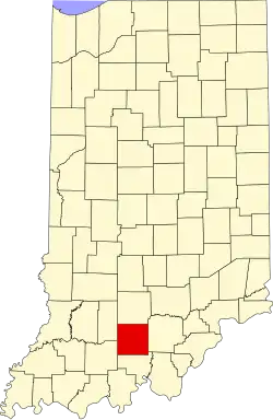 | |
| Townships | ||
| CDP | ||
| Other communities | ||
| Footnotes | ‡This populated place also has portions in an adjacent county or counties | |