Newman, Kansas
Newman, Kansas | |
|---|---|
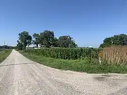 Newman at junction between Bridge and Newman Road (2025) | |
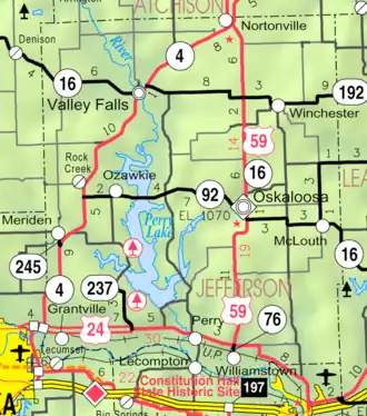 KDOT map of Jefferson County (legend) | |
 Newman  Newman | |
| Coordinates: 39°04′50″N 95°27′53″W / 39.08056°N 95.46472°W[1] | |
| Country | United States |
| State | Kansas |
| County | Jefferson |
| Township | Kentucky |
| Founded | 1867 |
| Named after | H. L. Newman[2] |
| Elevation | 863 ft (263 m) |
| Time zone | UTC-6 (CST) |
| • Summer (DST) | UTC-5 (CDT) |
| Area code | 785 |
| FIPS code | 20-50400 [1] |
| GNIS ID | 478808 [1] |
Newman is an unincorporated community in southern Jefferson County, United States.[1]
History
Newman was laid out in 1867.[3]
A post office was opened in Newman in 1868 and remained in operation until it was closed in 1969.[4]
See also
References
- ^ a b c d e "Newman, Kansas", Geographic Names Information System, United States Geological Survey, United States Department of the Interior
- ^ "Newman, Kansas – Extinct in Jefferson County". Legends of Kansas. Retrieved October 20, 2024.
- ^ Blackmar, Frank Wilson (1912). Kansas: A Cyclopedia of State History, Volume 2. Standard Publishing Company. pp. 358.
- ^ "Kansas Post Offices, 1828-1961 (archived)". Kansas Historical Society. Archived from the original on October 9, 2013. Retrieved June 11, 2014.
Further reading
Municipalities and communities of Jefferson County, Kansas, United States | ||
|---|---|---|
| Cities | 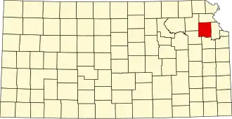 | |
| CDPs | ||
| Unincorporated communities | ||
| Townships | ||