Munson, Florida
Munson, Florida | |
|---|---|
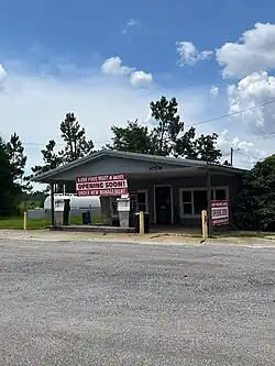 Store in Munson | |
 Munson, Florida  Munson, Florida | |
| Coordinates: 30°51′28″N 86°52′23″W / 30.85778°N 86.87306°W | |
| Country | United States |
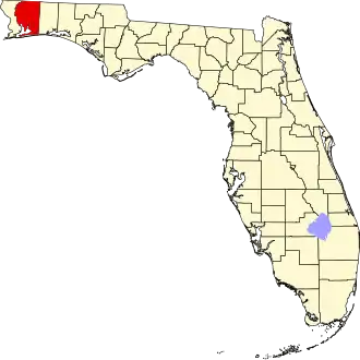
| State | Florida |
| County | Santa Rosa |
| Area | |
• Total | 25.355 sq mi (65.67 km2) |
| • Land | 25.264 sq mi (65.43 km2) |
| • Water | 0.091 sq mi (0.24 km2) |
| Elevation | 210 ft (60 m) |
| Population | |
• Total | 326 |
| • Density | 13/sq mi (5.0/km2) |
| Time zone | UTC-6 (Central (CST)) |
| • Summer (DST) | UTC-5 (CDT) |
| Area code | 850 |
| GNIS feature ID | 294860[2] |
Munson is an unincorporated community and census-designated place in Santa Rosa County, Florida, United States. Its population was 326 at the 2020 census,[3] down from 372 as of the 2010 census.[1] It is part of the Pensacola—Ferry Pass—Brent, Florida Metropolitan Statistical Area. Florida State Road 4 passes through the community.
Geography
According to the U.S. Census Bureau, the community has an area of 25.355 square miles (65.67 km2); 25.264 square miles (65.43 km2) of its area is land, and 0.091 square miles (0.24 km2) is water.[1]
References
- ^ a b c d "2010 Census Gazetteer Files - Places: Florida". U.S. Census Bureau. Retrieved March 26, 2017.
- ^ "Munson". Geographic Names Information System. United States Geological Survey, United States Department of the Interior.
- ^ "Explore Census Data". data.census.gov. Retrieved May 13, 2024.