Mulegé Airstrip
Mulegé Airstrip | |||||||||||
|---|---|---|---|---|---|---|---|---|---|---|---|
| Summary | |||||||||||
| Airport type | Public, General aviation | ||||||||||
| Serves | Mulegé | ||||||||||
| Location | Mulegé Municipality, Baja California Sur, Mexico | ||||||||||
| Elevation AMSL | 124 ft / 38 m | ||||||||||
| Coordinates | 26°54′21″N 111°58′14″W / 26.90583°N 111.97056°W | ||||||||||
| Map | |||||||||||
 MUG Location of airport in Baja California Sur  MUG MUG (Mexico) | |||||||||||
| Runways | |||||||||||
| |||||||||||
| Statistics (2016) | |||||||||||
| |||||||||||
Source: Dirección General de Aeronáutica Civil | |||||||||||
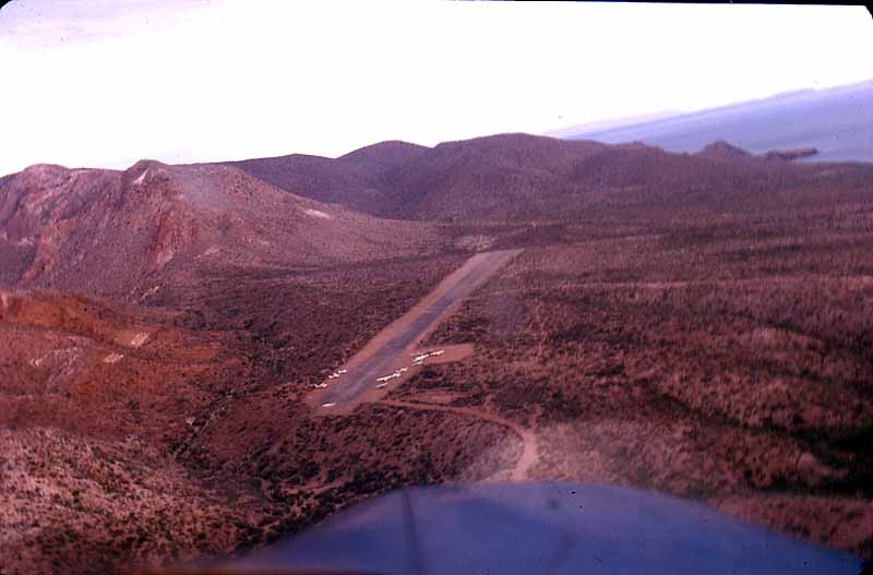
Mulegé Airstrip or Mulegé Municipal Airstrip (IATA: MUG, ICAO: MMMG) is a public dirt airstrip located 3 kilometres (1.9 mi) northeast of the town of Mulegé, in the Municipality of Mulegé, Baja California Sur state, northwest Mexico.
It is on the north bank of the Mulegé River, 3 kilometres (1.9 mi) from the Gulf of California coast.
The airstrip is used solely for general aviation purposes. It is a secondary airport to the El Gallito Airstrip, which is the most used, due to better quality installations and safety conditions. [1]
External links