Muddy Creek (Slippery Rock Creek tributary)
| Muddy Creek Tributary to Slippery Rock Creek | |
|---|---|
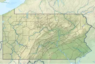 Location of Muddy Creek mouth  Muddy Creek (Slippery Rock Creek tributary) (the United States) | |
| Location | |
| Country | United States |
| State | Pennsylvania |
| Counties | Butler Lawrence |
| Physical characteristics | |
| Source | divide between Muddy Creek and Allegheny River |
| • location | about 1 mile southeast of West Sunbury, Pennsylvania[2] |
| • coordinates | 40°59′39″N 080°10′46″W / 40.99417°N 80.17944°W[1] |
| • elevation | 1,370 ft (420 m)[2] |
| Mouth | Slippery Rock Creek |
• location | about 0.5 miles downstream of Kennedy Mill[2] |
• coordinates | 40°58′48″N 079°52′31″W / 40.98000°N 79.87528°W[1] |
• elevation | 1,040 ft (320 m)[2] |
| Length | 20.14 mi (32.41 km)[3] |
| Basin size | 80.66 square miles (208.9 km2)[4] |
| Discharge | |
| • location | Slippery Rock Creek |
| • average | 80.66 cu ft/s (2.284 m3/s) at mouth with Slippery Rock Creek[4] |
| Basin features | |
| Progression | Slippery Rock Creek → Connoquenessing Creek → Beaver River → Ohio River → Mississippi River → Gulf of Mexico |
| River system | Beaver River |
| Tributaries | |
| • left | Swamp Run Shannon Run Big Run Bear Run |
| • right | unnamed tributaries |
| Waterbodies | Lake Arthur |
| Bridges | Vidic Road, W Sunbury Road, N Beaver Dam Road, Shroyer Mill Road, William Flynn Highway (PA 8), PA 528, W Park Road, I-79, Currie Road, Book Road, US 19 |
Muddy Creek is a tributary of Slippery Rock Creek in Butler and Lawrence Counties in Pennsylvania in the United States.[5] The run is 23.2 miles (37.3 km) long, flows generally west, and its watershed is 58.2 square miles (150.7 km2) in area.[6] Muddy Creek is the main water source for Lake Arthur in Moraine State Park.
See also
References
- ^ a b "GNIS Detail - Muddy Creek". geonames.usgs.gov. US Geological Survey. Retrieved 28 July 2019.
- ^ a b c d "Muddy Creek Topo Map, Butler County PA (Mount Chestnut Area)". TopoZone. Locality, LLC. Retrieved 28 July 2019.
- ^ "ArcGIS Web Application". epa.maps.arcgis.com. US EPA. Retrieved 28 July 2019.
- ^ a b "Muddy Creek Watershed Report". Waters Geoviewer. US EPA. Retrieved 28 July 2019.
- ^ U.S. Geological Survey Geographic Names Information System: Muddy Creek (Slippery Rock Creek tributary)
- ^ Shaw, Lewis C. Pennsylvania Gazetteer of Streams Part II (Water Resources Bulletin No. 16). Prepared in Cooperation with the United States Department of the Interior Geological Survey (1st ed.). Harrisburg, PA: Commonwealth of Pennsylvania, Department of Environmental Resources. OCLC 17150333.