Mount Shindainichi
| Mount Shindainichi | |
|---|---|
| 新大日 | |
 Mt.Shindainichi from Mt.Karasuo | |
| Highest point | |
| Elevation | 1,340 m (4,400 ft) |
| Coordinates | 35°27′05″N 139°10′36″E / 35.45139°N 139.17667°E |
| Geography | |
| Location | Kanagawa, Japan |
| Parent range | Tanzawa Mountains |
| Climbing | |
| First ascent | unknown |
| Easiest route | Hike |
Mount Shindainichi (新大日) is a peak of the Tanzawa Mountains with an elevation of 1,340 metres (4,396 ft),[1] and is located due east of Mount Tō. It is located within the boundary of the Tanzawa-Ōyama Quasi-National Park.
The mountain is easily accessible by a hiking trail from Yabitsu Pass, which intersects with the Nagaone Trail from the village of Kiyokawa, and with the trail leading directly to Mount Tō which is approximately a 40-minute hike.
Gallery
-
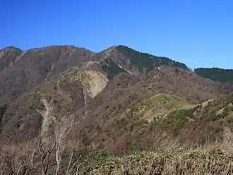
 Mount To, Mount Shindainichi and Mount Tanzawa from Mount Sannoto
 -
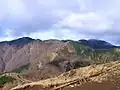
 Mount Shindainichi from Mount Gyoja
 -
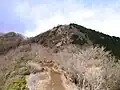
 A hut on the top of Mount Shindainichi
 -
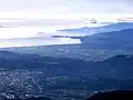 Odawara City and Izu Peninsula from Mount Shindainichi
References
- ^ "Mount Shindainichi Mountain Information". www.mountain-forecast.com. Retrieved 2024-10-16.
Wikimedia Commons has media related to Mount Shindainichi.