Mount Sajikigatake
| Mount Sajikigatake | |
|---|---|
| Mt. Sajiki | |
 | |
| Highest point | |
| Elevation | 895.7 m (2,939 ft) |
| Coordinates | 35°09′33″N 135°43′02″E / 35.1592°N 135.7173°E |
| Naming | |
| Native name | 桟敷ヶ岳 (Japanese) |
| Geography | |
| Location | Kyoto Prefecture, Japan |
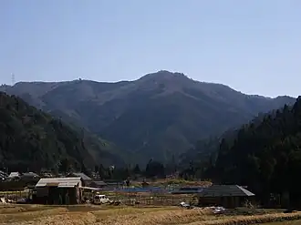
Mount Sajikigatake (桟敷ヶ岳) is a mountain located in Kita-ku, part of Kyoto city, Kyoto Prefecture, Japan.[1]
The Kamo River has its source in the area of the mountain.
For experienced hikers it is a popular trip; they can start in Kumogahata-cho (Kumogahata Town) and after the peak, they can continue to Onogo-cho (Onogo Town).[2][3]
References
- ^ "Mt. Sajikigatake". Retrieved 25 March 2017.
- ^ "Sajikigatake (Mt Sajiki)". Retrieved 25 March 2017.
- ^ "Sajikigatake". Retrieved 25 March 2017.
External links