Mount Chūbetsu
| Mount Chūbetsu | |
|---|---|
| 忠別岳 | |
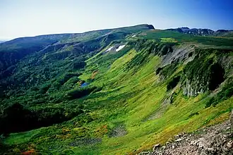 Mount Chubetsu and Kogen-numa | |
| Highest point | |
| Elevation | 1,962.8 m (6,440 ft)[1] |
| Listing | List of mountains and hills of Japan by height |
| Coordinates | 43°35′19″N 142°53′54″E / 43.58861°N 142.89833°E[2] |
| Geography | |
 Mount Chūbetsu Location of Mount Chūbetsu in Japan 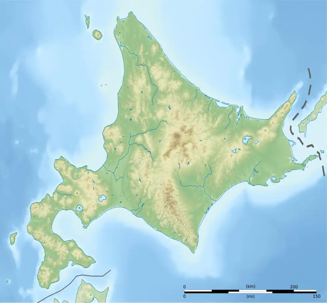 Mount Chūbetsu Mount Chūbetsu (Hokkaido) | |
| Location | Hokkaidō, Japan |
| Topo map(s) | Geographical Survey Institute (国土地理院, Kokudochiriin) 25000:1 白雲岳 50000:1 旭川 |
| Geology | |
| Rock age | Quaternary |
| Mountain type | Stratovolcano |
| Last eruption | 800 thousand to 1 million years ago |
Mount Chūbetsu (忠別岳, Chūbetsu-dake) is located in the Daisetsuzan National Park, Hokkaidō, Japan. It is an andesitic stratovolcano.[2]
References
- ^ 地図閲覧サービス 2万5千分1地形図名:白雲岳(旭川) (in Japanese). Geospatial Information Authority of Japan. Retrieved 20 September 2010.
- ^ a b "CHUBETSU-DAKE". Quatrernary Volcanoes in Japan. Geological Survey of Japan, AIST. Archived from the original on 19 December 2012. Retrieved 20 September 2010.
External links
- "Chubetsu". Global Volcanism Program. Smithsonian Institution. Retrieved 25 June 2021.