Mount Albert Edward (British Columbia)
| Mount Albert Edward | |
|---|---|
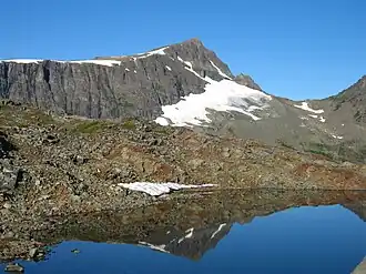 Summit of Mount Albert Edward | |
| Highest point | |
| Elevation | 2,093 m (6,867 ft)[1] |
| Prominence | 1,203 m (3,947 ft)[1] |
| Listing | Mountains of British Columbia |
| Coordinates | 49°40′40″N 125°25′54″W / 49.67778°N 125.43167°W[1] |
| Geography | |
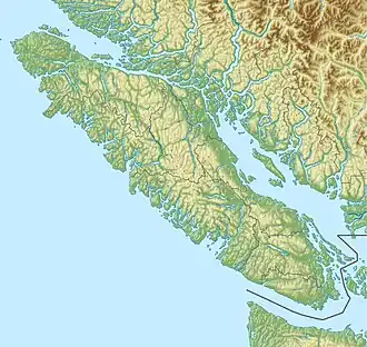 Mount Albert Edward Location on Vancouver Island  Mount Albert Edward Location in British Columbia | |
| Interactive map of Mount Albert Edward | |
| Location | Vancouver Island, British Columbia, Canada |
| District | Comox Land District |
| Parent range | Vancouver Island Ranges |
| Topo map | NTS 92F11 Forbidden Plateau |
| Climbing | |
| First ascent | 1890 by William Ralph[1] |
| Easiest route | Hikers route via the North East Ridge accessed from Paradise Meadows |
Mount Albert Edward is the sixth highest peak on Vancouver Island and one of the most easily accessible. Located in Strathcona Provincial Park, the mountain is a popular destination both in summer for hikers and in winter for skiers and snowshoers. The mountain is named for Albert Edward, the Prince of Wales, later Edward VII.[2]
See also
References
- ^ a b c d "Mount Albert Edward". Bivouac.com. Retrieved 2006-06-05.
- ^ "Mount Albert Edward". BC Geographical Names. Retrieved 2021-04-04.
External links
- Club Tread
 Media related to Mount Albert Edward (British Columbia) at Wikimedia Commons